Click on an image for detailed information
Click on a column heading to sort in ascending or descending order

My
List |
Addition Date
|
Target
|
Mission
|
Instrument
|
Size
|

|
2015-09-02 |
Mars
|
2001 Mars Odyssey
Mars Reconnaissance Orbiter (MRO)
|
CRISM
THEMIS
|
1234x616x3 |
|
-
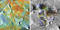
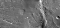
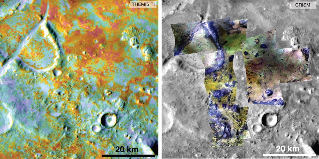
PIA19816:
-
Multiple Instruments Used for Mars Carbon Estimate
Full Resolution:
TIFF
(2.281 MB)
JPEG
(155.9 kB)
|
|
|
2016-05-03 |
Mars
|
2001 Mars Odyssey
Mars Reconnaissance Orbiter (MRO)
|
CRISM
THEMIS
|
758x747x3 |
|
-
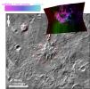
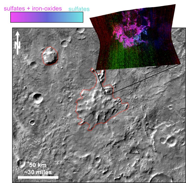
PIA20335:
-
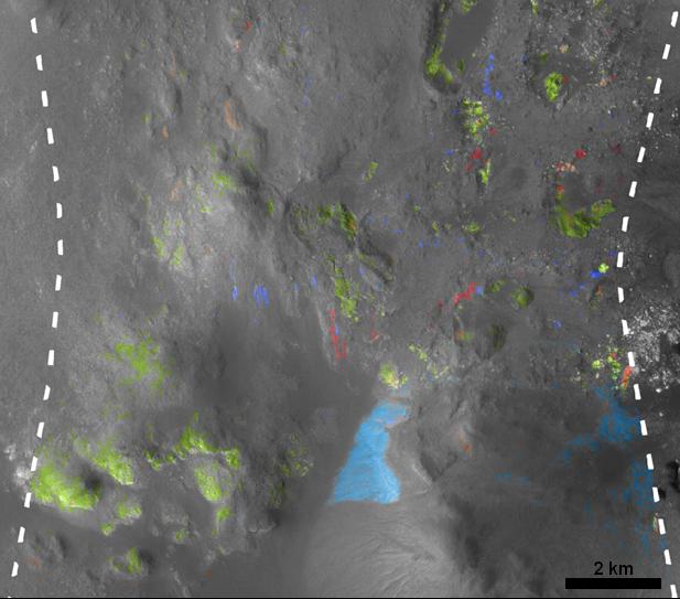
Evidence Builds for Old Under-Ice Volcanoes on Mars
Full Resolution:
TIFF
(943.9 kB)
JPEG
(110 kB)
|
|
|
2013-06-11 |
Mars
|
2001 Mars Odyssey
Mars Reconnaissance Orbiter (MRO)
Mars Global Surveyor (MGS)
|
HiRISE
Mars Orbiter Camera (MOC)
THEMIS
|
960x608x3 |
|
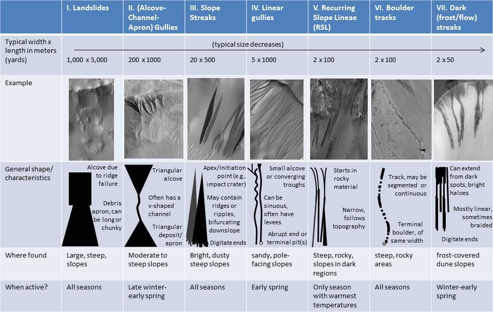
-
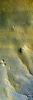
PIA17079:
-
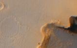
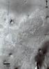
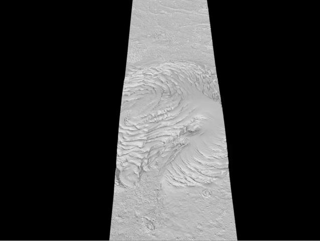
Martian Features Formed When Material Moves Downslope
Full Resolution:
TIFF
(1.752 MB)
JPEG
(100.9 kB)
|
|
|
2019-12-10 |
Mars
|
2001 Mars Odyssey
Mars Reconnaissance Orbiter (MRO)
Mars Global Surveyor (MGS)
|
MCS
THEMIS
|
1614x720x3 |
|
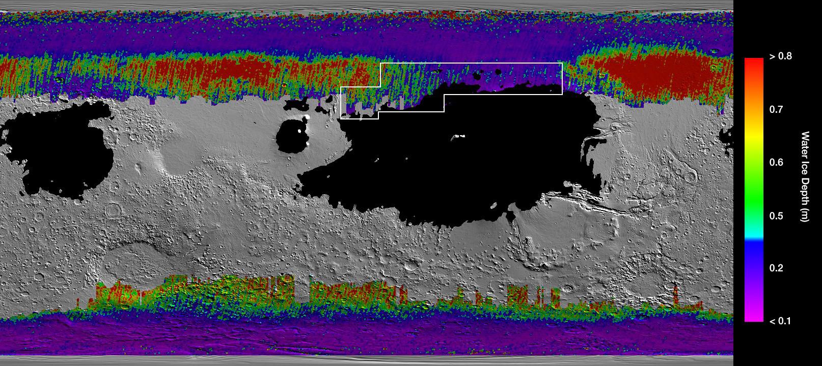
-
PIA23514:
-
A Water Ice Map for Mars
Full Resolution:
TIFF
(2.369 MB)
JPEG
(311.5 kB)
|
|
|
2011-08-05 |
Mars
|
Mars Exploration Rover (MER)
|
CTX
|
943x1989x3 |
|
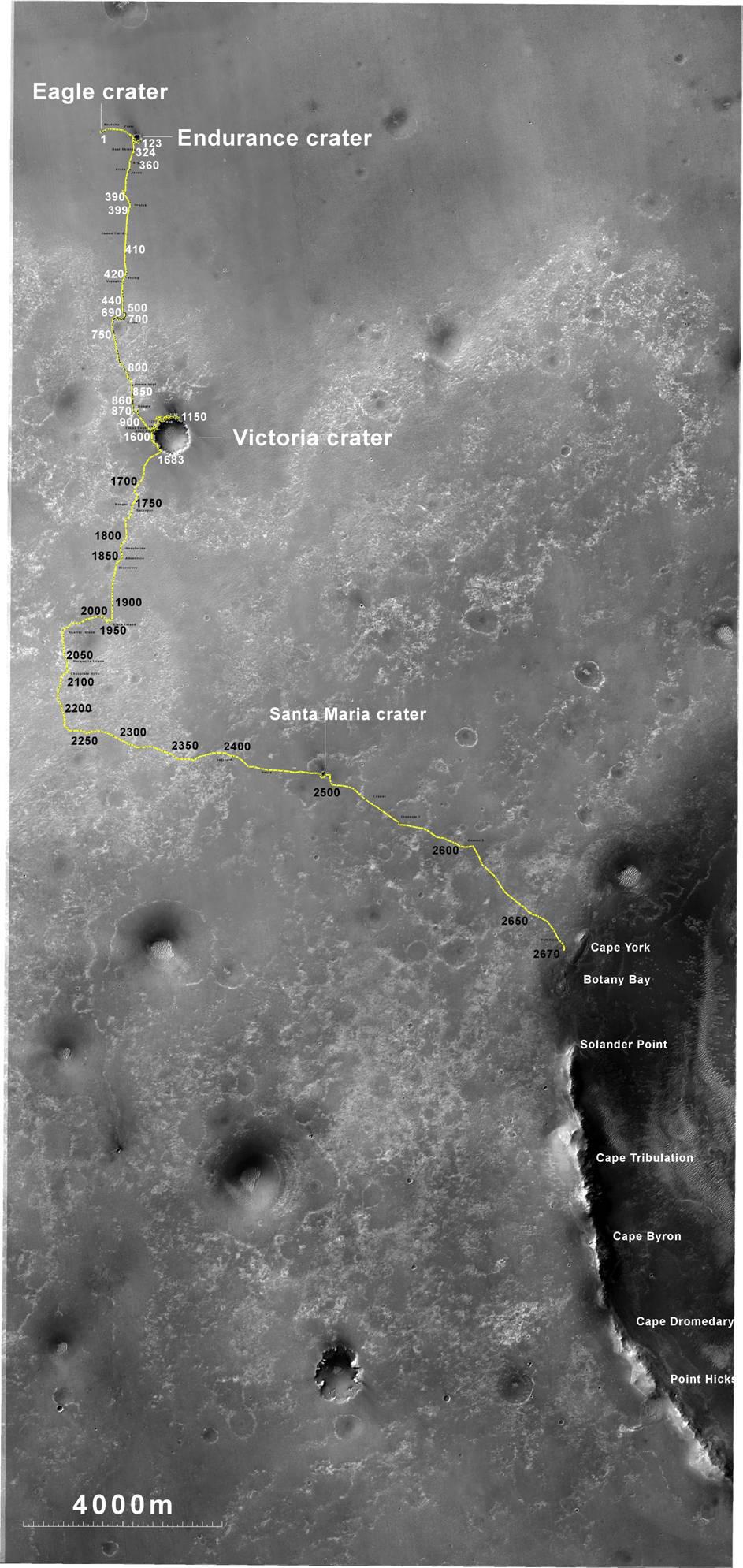
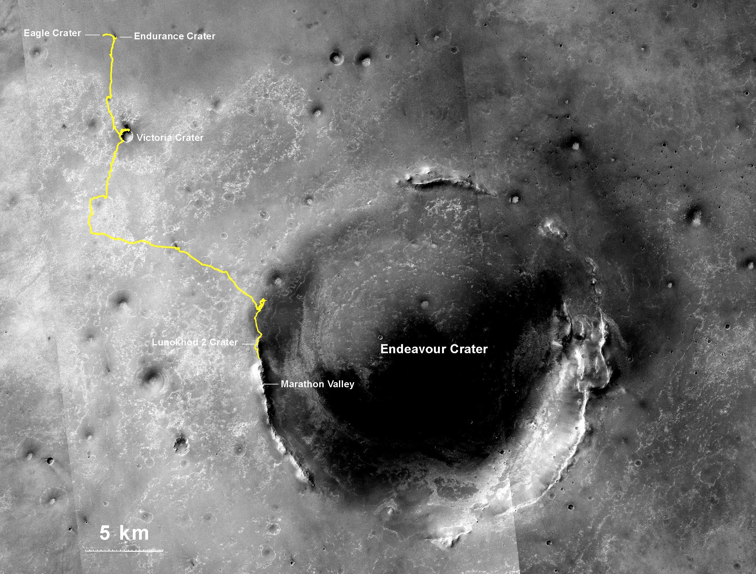
-
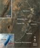
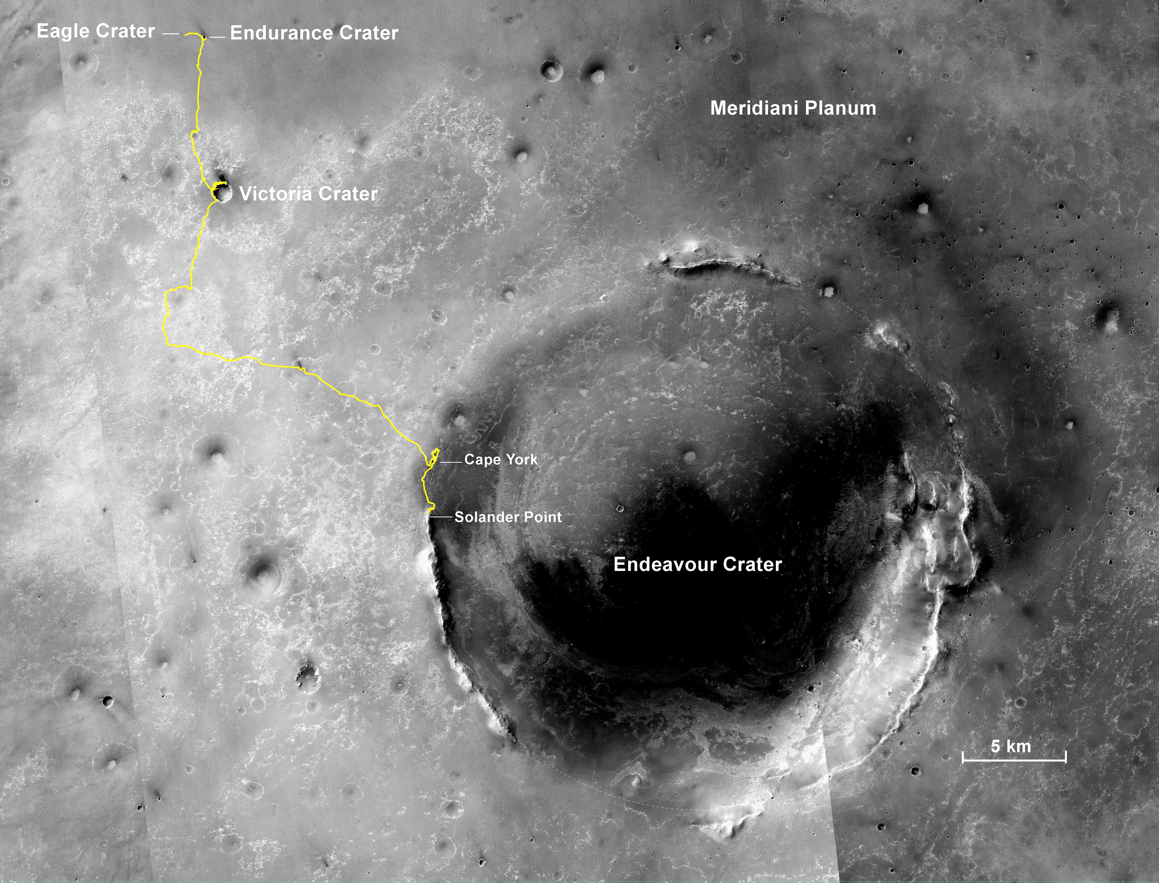
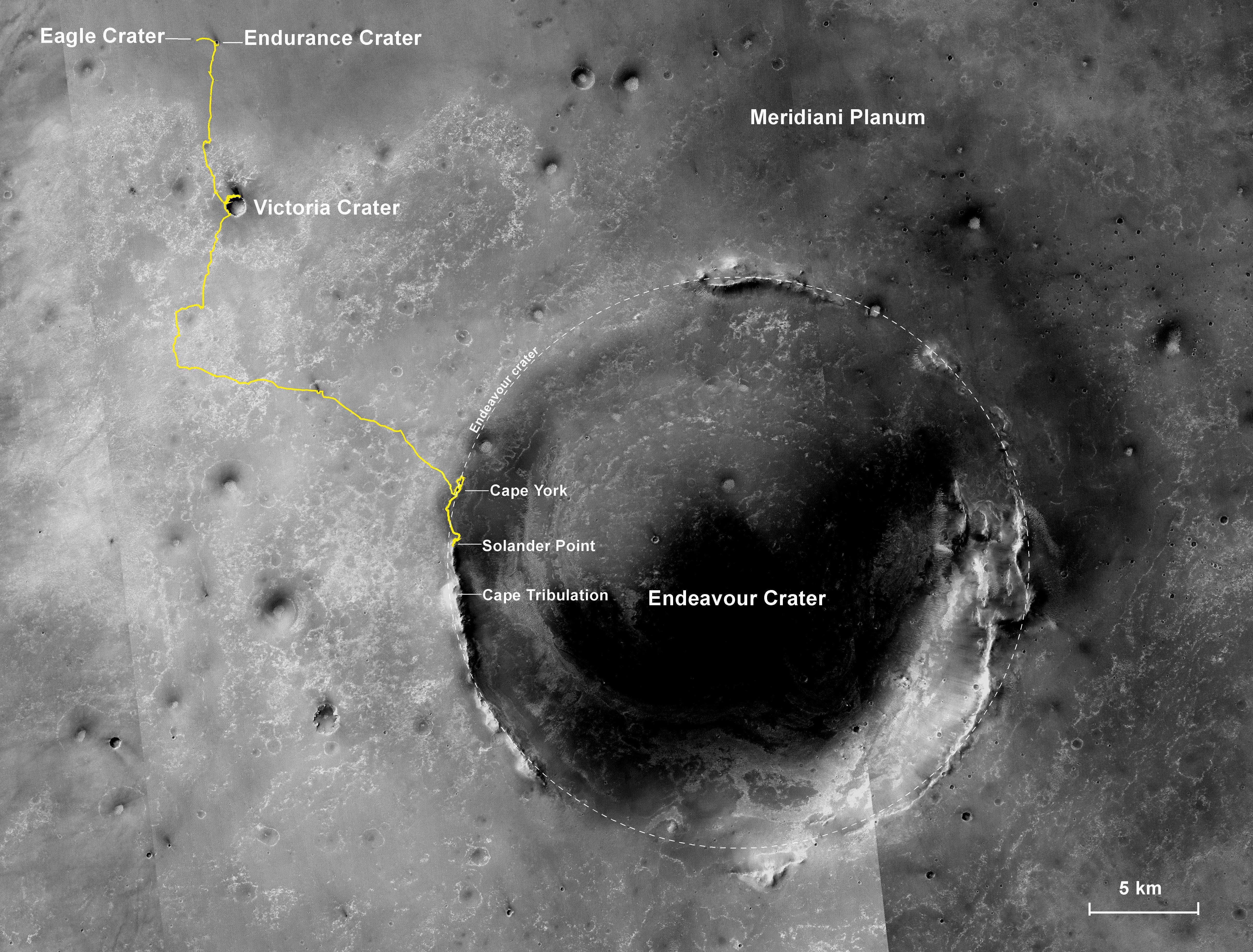
PIA14504:
-
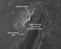
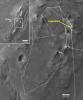
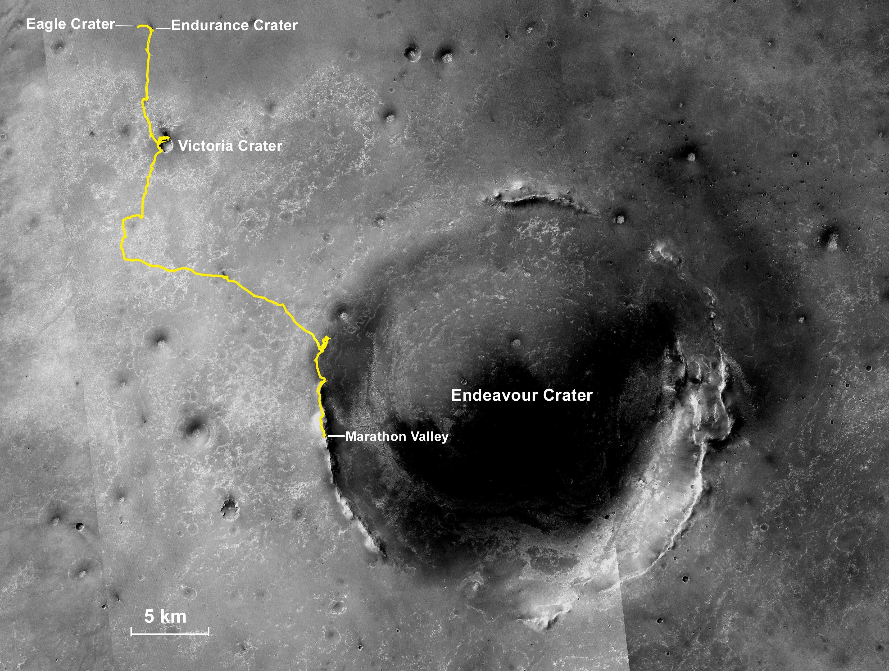
Opportunity's Route to Endeavour Crater
Full Resolution:
TIFF
(5.635 MB)
JPEG
(260 kB)
|
|
|
2011-08-05 |
Mars
|
Mars Exploration Rover (MER)
|
CTX
|
943x759x3 |
|
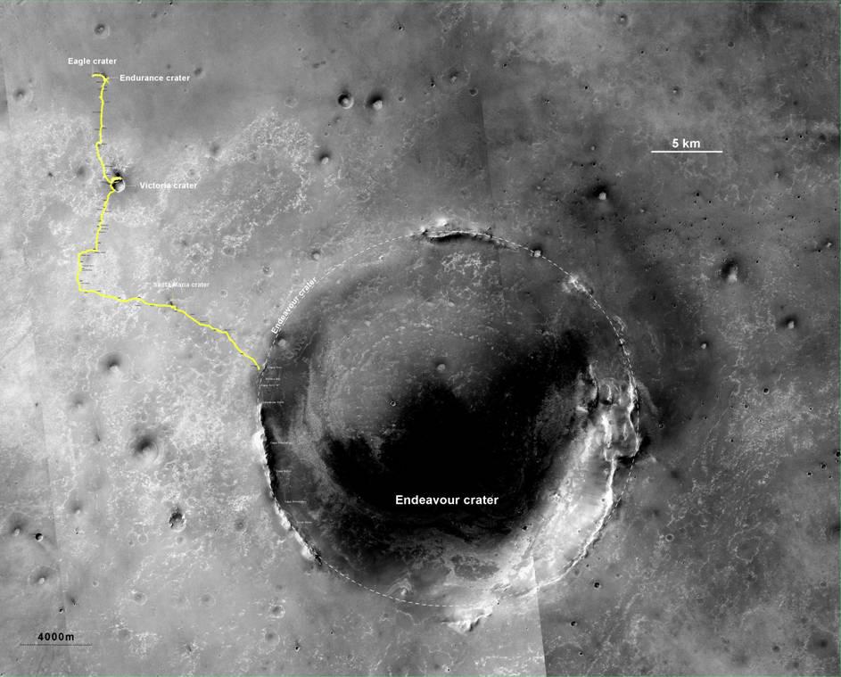
-
PIA14505:
-
Opportunity's Route to Endeavour Crater (Wide View)
Full Resolution:
TIFF
(2.15 MB)
JPEG
(101 kB)
|
|
|
2013-05-17 |
Mars
|
Mars Exploration Rover (MER)
|
HiRISE
|
793x1209x1 |
|
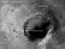
-
PIA16931:
-
Opportunity Heads Toward Next Destination, 'Solander Point'
Full Resolution:
TIFF
(959.9 kB)
JPEG
(122.1 kB)
|
|
|
2015-03-24 |
Mars
|
Mars Exploration Rover (MER)
|
CTX
|
3360x2537x3 |
|
-
PIA19154:
-
Opportunity Rover's Full Marathon-Length Traverse
Full Resolution:
TIFF
(25.58 MB)
JPEG
(1.516 MB)
|
|
|
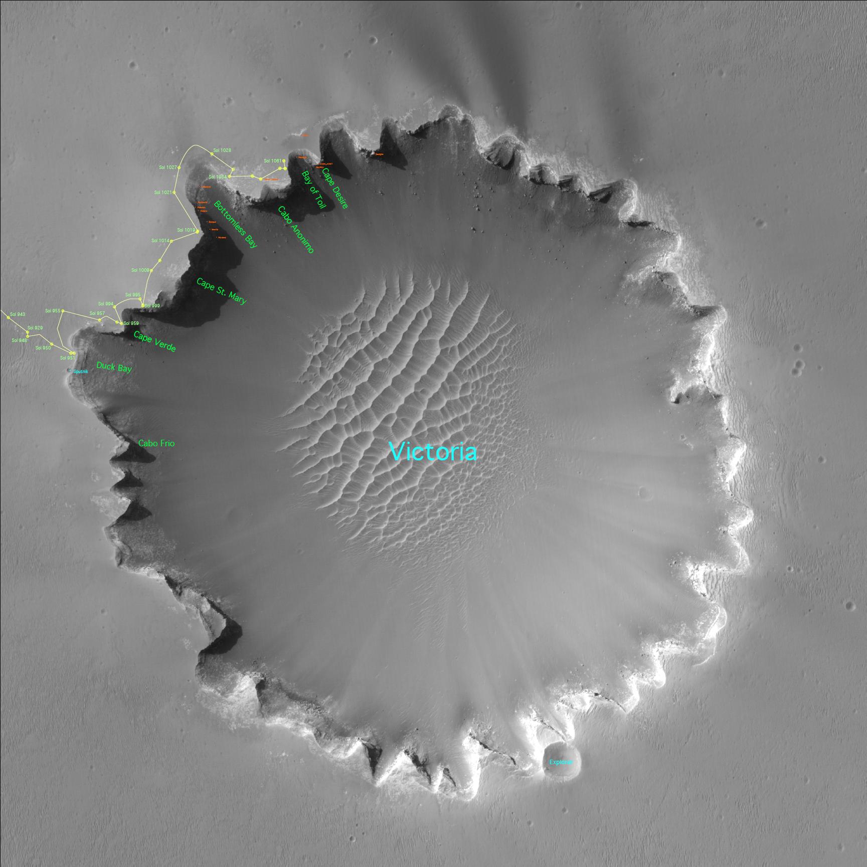
2006-10-06 |
Mars
|
Mars Exploration Rover (MER)
Mars Reconnaissance Orbiter (MRO)
|
HiRISE
|
1176x942x3 |

|
-
PIA08812:
-
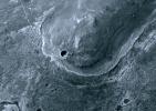
The Opportunity Rover at 'Victoria Crater'
Full Resolution:
TIFF
(3.327 MB)
JPEG
(159.1 kB)
|
|
|
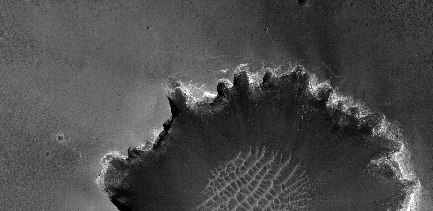
2006-10-06 |
Mars
|
Mars Exploration Rover (MER)
Mars Reconnaissance Orbiter (MRO)
|
HiRISE
|
1941x1230x3 |
|
-
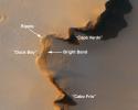
PIA08816:
-
Opportunity at Crater's 'Cape Verde'
Full Resolution:
TIFF
(7.172 MB)
JPEG
(264.8 kB)
|
|
|
2006-10-06 |
Mars
|
Mars Exploration Rover (MER)
Mars Reconnaissance Orbiter (MRO)
|
HiRISE
|
4045x5085x3 |
|
-
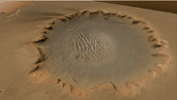
PIA08813:
-
'Victoria Crater' at Meridiani Planum
Full Resolution:
TIFF
(61.71 MB)
JPEG
(3.174 MB)
|
|
|
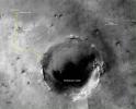
2006-10-06 |
Mars
|
Mars Exploration Rover (MER)
Mars Reconnaissance Orbiter (MRO)
|
HiRISE
|
1373x1049x1 |
|
-
PIA08817:
-
Opportunity at Crater's 'Cape Verde' (Red Filter)
Full Resolution:
TIFF
(1.442 MB)
JPEG
(130.9 kB)
|
|
|
2006-12-05 |
Mars
|
Mars Exploration Rover (MER)
Mars Reconnaissance Orbiter (MRO)
|
HiRISE
|
1663x1621x1 |
|
-
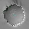
PIA01879:
-
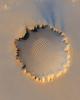
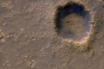
Mars Exploration Rover Landing Site at Gusev Crater
Full Resolution:
TIFF
(2.699 MB)
JPEG
(417.8 kB)
|
|
|
2006-12-05 |
Mars
|
Mars Exploration Rover (MER)
Mars Reconnaissance Orbiter (MRO)
|
HiRISE
|
773x1423x1 |
|
-
PIA01880:
-
Three-Frame 'Movie' of Opportunity Rover at 'Victoria Crater'
Full Resolution:
TIFF
(1.101 MB)
JPEG
(115.2 kB)
|
|
|
2006-12-13 |
Mars
|
Mars Exploration Rover (MER)
Mars Reconnaissance Orbiter (MRO)
|
HiRISE
|
1151x1046x1 |
|
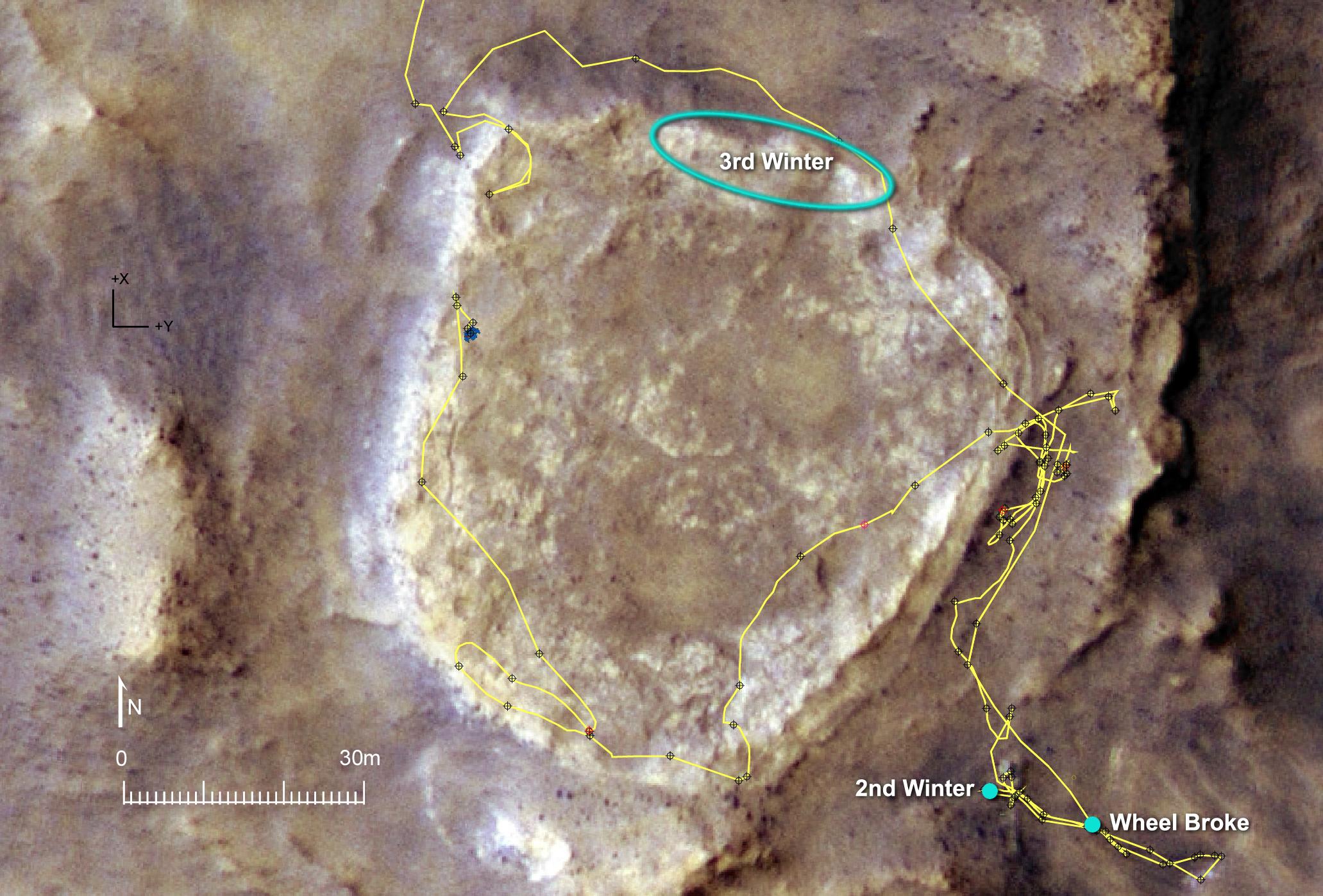
-
PIA09088:
-
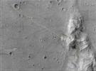
Spirit's Winter Work Site
Full Resolution:
TIFF
(1.205 MB)
JPEG
(256.4 kB)
|
|
|
2006-12-13 |
Mars
|
Mars Exploration Rover (MER)
Mars Reconnaissance Orbiter (MRO)
|
HiRISE
|
790x685x1 |
|
-
PIA09089:
-
Spirit's Tracks around 'Home Plate'
Full Resolution:
TIFF
(541.9 kB)
JPEG
(124 kB)
|
|
|
2007-01-19 |
Mars
|
Mars Exploration Rover (MER)
Mars Reconnaissance Orbiter (MRO)
|
HiRISE
|
1000x1000x11 |
|
-
PIA09114:
-
Rovers Get New Driving Capability

Full Resolution:
TIFF
(22.64 MB)
JPEG
(714.6 kB)
|
|
|
2007-01-23 |
Mars
|
Mars Exploration Rover (MER)
Mars Reconnaissance Orbiter (MRO)
|
HiRISE
|
1729x1729x3 |
|
-
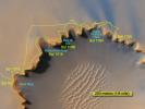
PIA09116:
-
Satellite View of Opportunity's Journey around "Victoria Crater"
Full Resolution:
TIFF
(8.982 MB)
JPEG
(261.1 kB)
|
|
|
2007-06-28 |
Mars
|
Mars Exploration Rover (MER)
Mars Reconnaissance Orbiter (MRO)
|
Panoramic Camera
High Resolution Imaging Science Experiment (HiRISE)
|
639x361x3 |
|
-
PIA09687:
-
Surveying the Scene Above Opportunity (Simulation)
Full Resolution:
TIFF
(693 kB)
JPEG
(21.41 kB)
|
|
|
2007-06-28 |
Mars
|
Mars Exploration Rover (MER)
Mars Reconnaissance Orbiter (MRO)
|
HiRISE
|
1176x942x3 |
|
-
PIA09690:
-
Opportunity Gets Ready to Roll
Full Resolution:
TIFF
(3.327 MB)
JPEG
(165.4 kB)
|
|
|
2007-06-28 |
Mars
|
Mars Exploration Rover (MER)
Mars Reconnaissance Orbiter (MRO)
|
HiRISE
|
1792x877x1 |

|
-
PIA09692:
-
Rover Tracks at Crater's Edge
Full Resolution:
TIFF
(1.574 MB)
JPEG
(263.1 kB)
|
|
|
2007-06-28 |
Mars
|
Mars Exploration Rover (MER)
Mars Reconnaissance Orbiter (MRO)
|
HiRISE
|
720x540x3 |
|
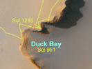
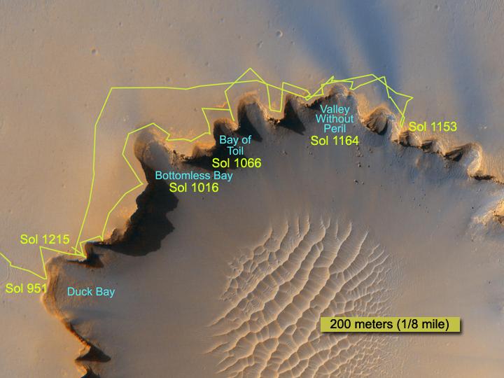
-
PIA09696:
-
Crater Rim Path, Sol 1,215
Full Resolution:
TIFF
(1.168 MB)
JPEG
(46.69 kB)
|
|
|
2007-12-10 |
Mars
|
Mars Exploration Rover (MER)
Mars Reconnaissance Orbiter (MRO)
|
HiRISE
|
3688x2720x3 |
|
-
PIA10126:
-
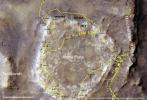
Spirit's Traverse, Sols 1 to 1,386
Full Resolution:
TIFF
(30.09 MB)
JPEG
(2.09 MB)
|
|
|
2007-12-10 |
Mars
|
Mars Exploration Rover (MER)
Mars Reconnaissance Orbiter (MRO)
|
HiRISE
|
2063x1397x3 |
|
-
PIA10127:
-
Heading for Next Winter Haven
Full Resolution:
TIFF
(8.657 MB)
JPEG
(398.4 kB)
|
|
|
2007-12-10 |
Mars
|
Mars Exploration Rover (MER)
Mars Reconnaissance Orbiter (MRO)
|
HiRISE
|
1052x717x3 |
|
-
PIA10129:
-
Spirit Nears North-Tilting Site for Winter Haven
Full Resolution:
TIFF
(2.266 MB)
JPEG
(143.3 kB)
|
|
|
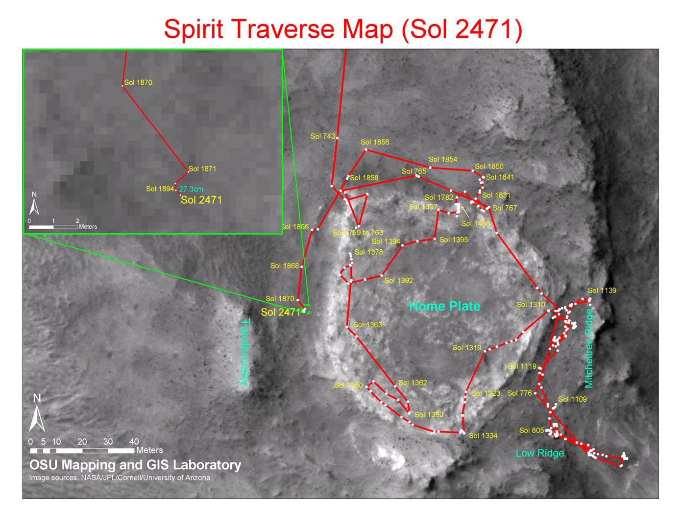
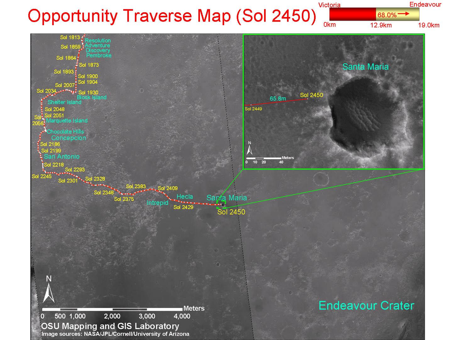
2010-12-17 |
Mars
|
Mars Exploration Rover (MER)
Mars Reconnaissance Orbiter (MRO)
|
CTX
|
1392x1080x3 |
|
-
PIA13730:
-
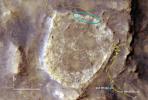
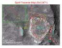
Spirit Traverse Map, Sol 2471
Full Resolution:
TIFF
(4.519 MB)
JPEG
(176.5 kB)
|
|
|
2010-12-17 |
Mars
|
Mars Exploration Rover (MER)
Mars Reconnaissance Orbiter (MRO)
|
CTX
|
1460x1080x3 |
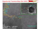
|
-
PIA13731:
-
Opportunity Traverse Map, Sol 2450
Full Resolution:
TIFF
(4.739 MB)
JPEG
(178 kB)
|
|
|
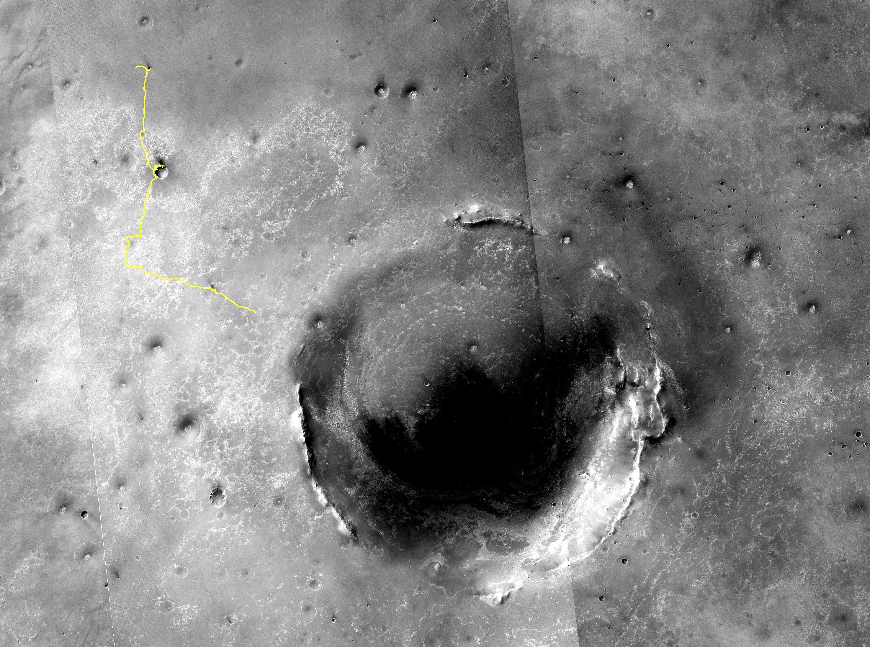
2011-01-04 |
Mars
|
Mars Exploration Rover (MER)
Mars Reconnaissance Orbiter (MRO)
|
HiRISE
|
1347x1277x1 |

|
-
PIA13754:
-
Mars Orbiter Sees Rover Opportunity at Crater Edge
Full Resolution:
TIFF
(1.722 MB)
JPEG
(195 kB)
|
|
|
2011-03-09 |
Mars
|
Mars Exploration Rover (MER)
Mars Reconnaissance Orbiter (MRO)
|
HiRISE
|
2254x1522x3 |
|
-
PIA13803:
-
Opportunity is Still Smiling
Full Resolution:
TIFF
(10.3 MB)
JPEG
(1.155 MB)
|
|
|
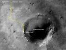
2011-06-08 |
Mars
|
Mars Exploration Rover (MER)
Mars Reconnaissance Orbiter (MRO)
|
HiRISE
|
8192x5789x3 |
|
-
PIA14134:
-
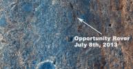
Opportunity's First Goal at Endeavour Crater: 'Spirit Point'
Full Resolution:
TIFF
(47.47 MB)
JPEG
(3.48 MB)
|
|
|
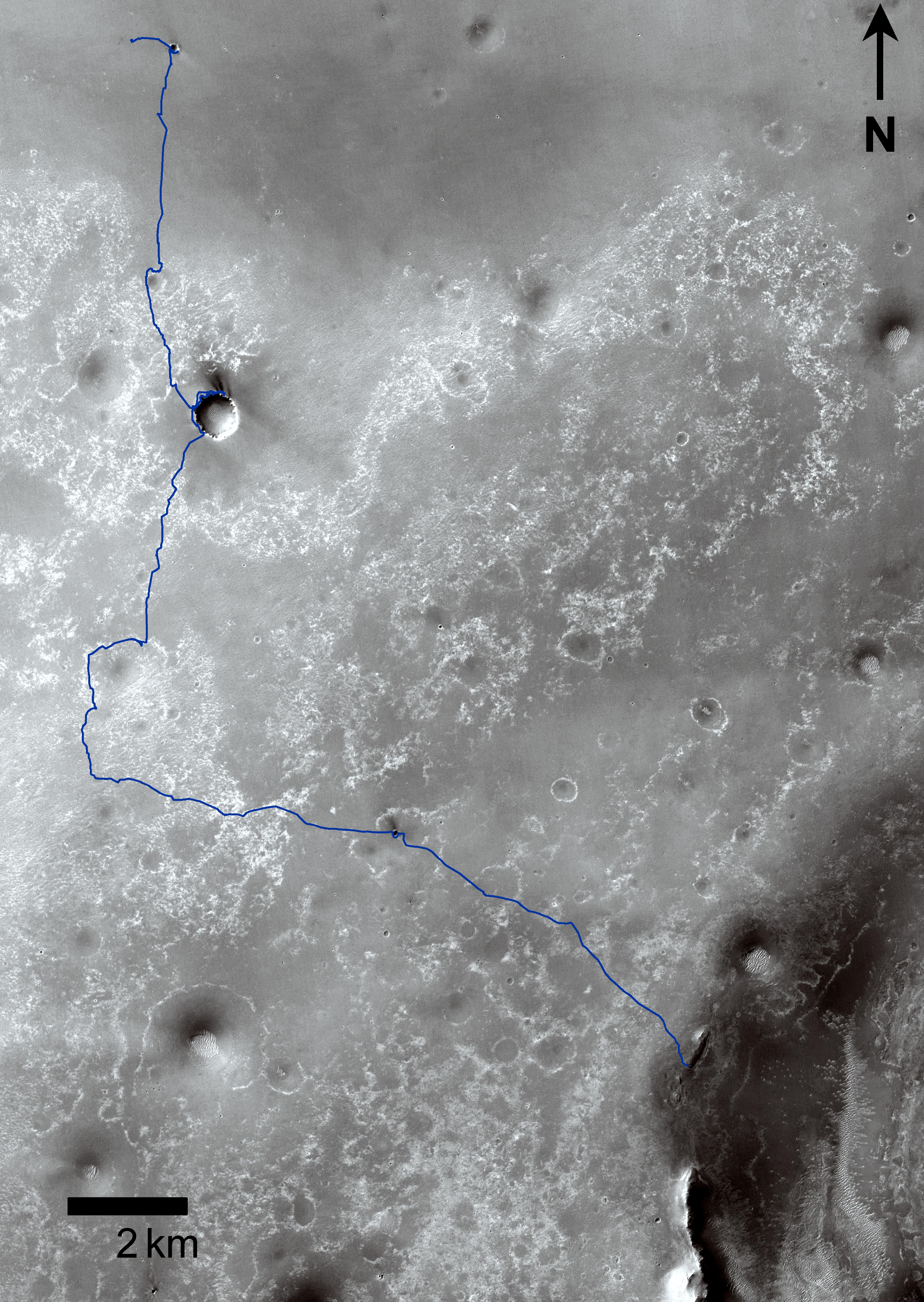
2011-06-08 |
Mars
|
Mars Exploration Rover (MER)
Mars Reconnaissance Orbiter (MRO)
|
CTX
|
2948x2193x3 |
|
-
PIA14135:
-
Eagle to Endeavour: Opportunity's Path, Sol 2609
Full Resolution:
TIFF
(19.4 MB)
JPEG
(1.319 MB)
|
|
|
2011-09-01 |
Mars
|
Mars Exploration Rover (MER)
Mars Reconnaissance Orbiter (MRO)
|
CTX
|
5664x7979x3 |
|
-
PIA14536:
-
Opportunity Traverses Through 2,700 Martian Days
Full Resolution:
TIFF
(45.26 MB)
JPEG
(6.766 MB)
|
|
|
2011-09-01 |
Mars
|
Mars Exploration Rover (MER)
Mars Reconnaissance Orbiter (MRO)
|
HiRISE
|
8192x5786x3 |
|
-
PIA14537:
-
Opportunity's First Neighborhood on Rim of Endeavour
Full Resolution:
TIFF
(142.2 MB)
JPEG
(5.631 MB)
|
|
|
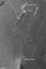
2012-01-05 |
Mars
|
Mars Exploration Rover (MER)
Mars Reconnaissance Orbiter (MRO)
|
HiRISE
|
700x560x1 |
|
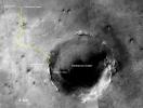
-
PIA15276:
-
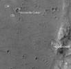
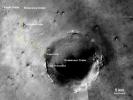
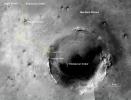
Locator Map for 'Greeley Haven' on Endeavour Rim
Full Resolution:
TIFF
(392.6 kB)
JPEG
(56.54 kB)
|
|
|
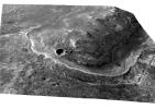
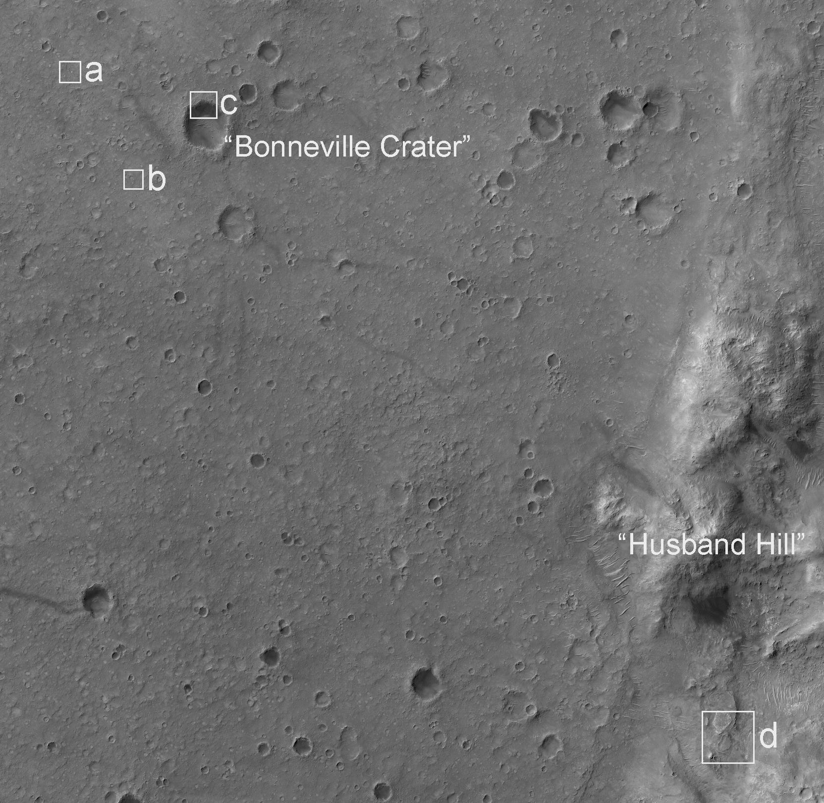
2012-02-08 |
Mars
|
Mars Exploration Rover (MER)
Mars Reconnaissance Orbiter (MRO)
|
HiRISE
|
2080x1393x3 |
|
-
PIA15038:
-
Spirit Lander and Bonneville Crater in Color
Full Resolution:
TIFF
(8.704 MB)
JPEG
(354.7 kB)
|
|
|
2013-06-07 |
Mars
|
Mars Exploration Rover (MER)
Mars Reconnaissance Orbiter (MRO)
|
CTX
|
5198x3900x3 |
|
-
PIA17070:
-
Opportunity's Traverse Through 112 Months
Full Resolution:
TIFF
(60.85 MB)
JPEG
(3.973 MB)
|
|
|
2013-06-07 |
Mars
|
Mars Exploration Rover (MER)
Mars Reconnaissance Orbiter (MRO)
|
HiRISE
|
3153x3788x3 |
|
-
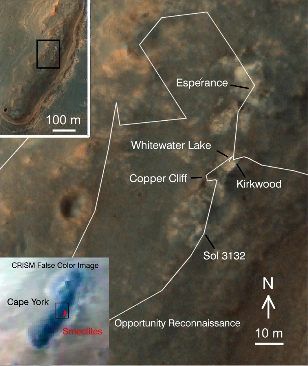
PIA17073:
-
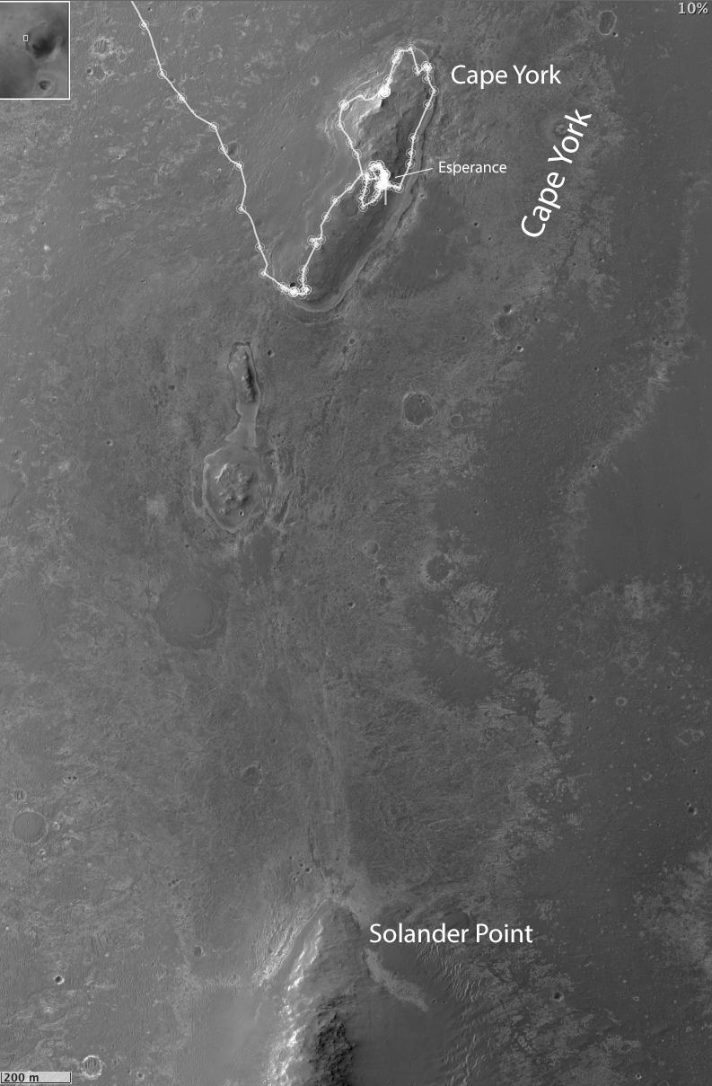
Opportunity's Exploration of "Cape York"
Full Resolution:
TIFF
(35.85 MB)
JPEG
(573.3 kB)
|
|
|
2013-07-17 |
Mars
|
Mars Exploration Rover (MER)
Mars Reconnaissance Orbiter (MRO)
|
HiRISE
|
1616x839x3 |
|
-
PIA17278:
-
Color View From Orbit Showing Opportunity in 'Botany Bay'
Full Resolution:
TIFF
(4.069 MB)
JPEG
(524.7 kB)
|
|
|
2013-12-03 |
Mars
|
Mars Exploration Rover (MER)
Mars Reconnaissance Orbiter (MRO)
|
CTX
|
4731x3605x3 |
|
-
PIA17589:
-
Opportunity's Journey, Approaching 10th Anniversary
Full Resolution:
TIFF
(51.19 MB)
JPEG
(3.199 MB)
|
|
|
2014-01-23 |
Mars
|
Mars Exploration Rover (MER)
Mars Reconnaissance Orbiter (MRO)
|
HiRISE
|
1064x1265x3 |
|
-
PIA17264:
-
'Cape York' Explored
Full Resolution:
TIFF
(4.04 MB)
JPEG
(138.1 kB)
|
|
|
2014-01-23 |
Mars
|
Mars Exploration Rover (MER)
Mars Reconnaissance Orbiter (MRO)
|
CTX
|
4853x3687x3 |
|
-
PIA17758:
-
Opportunity's First Decade of Driving on Mars
Full Resolution:
TIFF
(53.71 MB)
JPEG
(3.168 MB)
|
|
|
2014-02-19 |
Mars
|
Mars Exploration Rover (MER)
Mars Reconnaissance Orbiter (MRO)
|
HiRISE
|
1416x1441x3 |
|
-
PIA17941:
-
Opportunity Rover on 'Murray Ridge' Seen From Orbit
Full Resolution:
TIFF
(6.124 MB)
JPEG
(282.8 kB)
|
|
|
2014-07-28 |
Mars
|
Mars Exploration Rover (MER)
Mars Reconnaissance Orbiter (MRO)
|
CTX
|
2420x1838x3 |
|
-
PIA18404:
-
Opportunity's Journey Exceeds 25 Miles
Full Resolution:
TIFF
(13.35 MB)
JPEG
(943.2 kB)
|
|
|
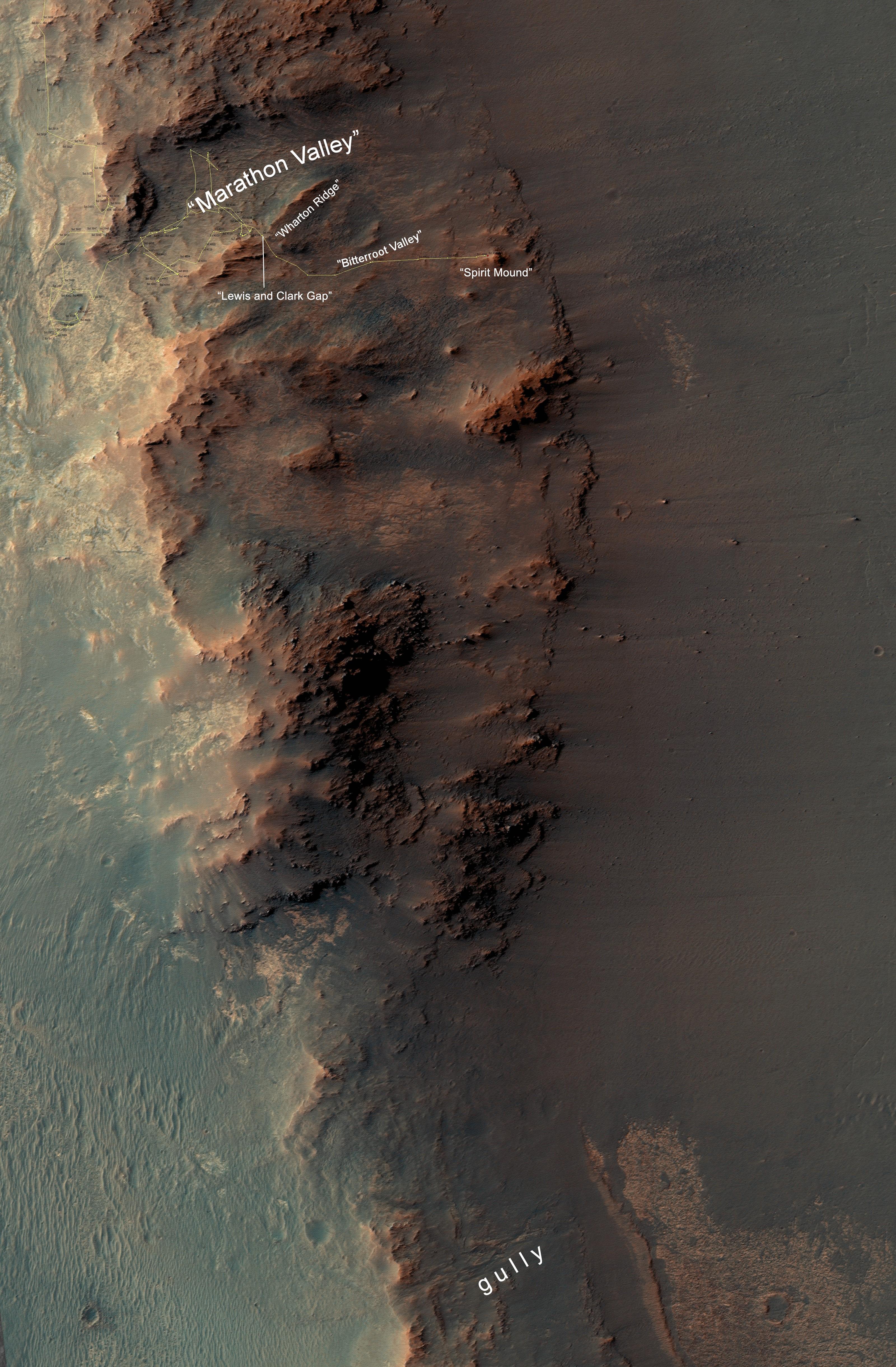
2016-10-07 |
Mars
|
Mars Exploration Rover (MER)
Mars Reconnaissance Orbiter (MRO)
|
HiRISE
|
3200x4880x3 |

|
-
PIA20854:
-
From 'Marathon Valley' to Gully on Endeavour Rim
Full Resolution:
TIFF
(41.84 MB)
JPEG
(2.035 MB)
|
|
|
2017-04-21 |
Mars
|
Mars Exploration Rover (MER)
Mars Reconnaissance Orbiter (MRO)
|
HiRISE
|
2558x2014x3 |
|
-
PIA21494:
-
Rover's Landing Hardware at Eagle Crater, Mars
Full Resolution:
TIFF
(11.9 MB)
JPEG
(733.9 kB)
|
|
|
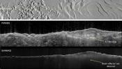
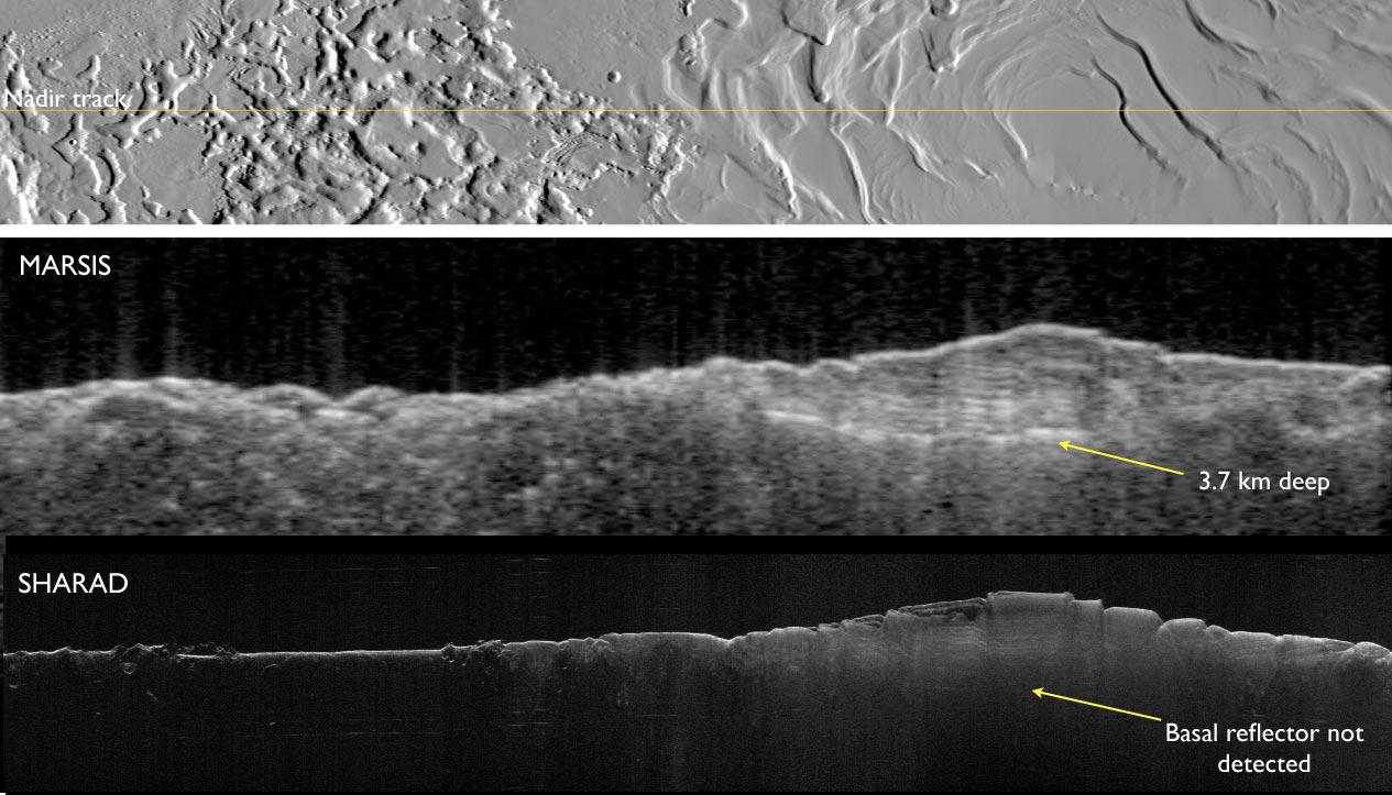
2008-04-17 |
Mars
|
Mars Express (MEX)
Mars Reconnaissance Orbiter (MRO)
|
MARSIS
Shallow Subsurface Radar (SHARAD)
|
1265x723x3 |
|
-
PIA10375:
-
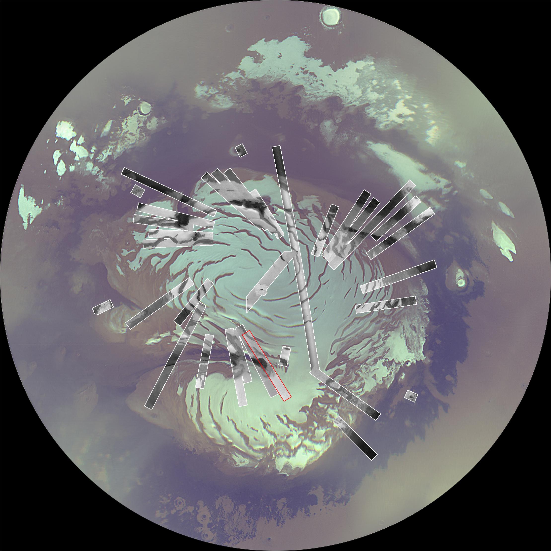
Two Radar Sounders Examine South Polar Layered Deposits on Mars
Full Resolution:
TIFF
(2.747 MB)
JPEG
(134.7 kB)
|
|
|
2008-04-17 |
Mars
|
Mars Express (MEX)
Mars Reconnaissance Orbiter (MRO)
|
MARSIS
Shallow Subsurface Radar (SHARAD)
|
516x387x1 |
|
-
PIA10376:
-
Mars Radar Opens a Planet's Third Dimension
Full Resolution:
TIFF
(307.4 kB)
JPEG
(20.51 kB)
|
|
|
2010-06-24 |
Mars
|
Mars Express (MEX)
Mars Reconnaissance Orbiter (MRO)
|
Context Camera
High Resolution Stereo Camera
|
617x543x3 |
|
-
PIA13214:
-
Hydrated Minerals Exposed at Stokes, Northern Mars
Full Resolution:
TIFF
(1.006 MB)
JPEG
(45.72 kB)
|
|
|
2007-06-28 |
Mars
|
Mars Global Surveyor (MGS)
Mars Exploration Rover (MER)
Mars Reconnaissance Orbiter (MRO)
|
HiRISE
Mars Orbiter Camera (MOC)
|
636x479x3 |
|
-
PIA09689:
-
Opportunity's Long Road to Victoria (Animation)
Full Resolution:
TIFF
(915.1 kB)
JPEG
(31.22 kB)
|
|
|
2006-04-13 |
Mars
|
Mars Global Surveyor (MGS)
Mars Reconnaissance Orbiter (MRO)
|
MARCI
Mars Orbiter Camer
|
1409x1056x3 |
|
-
PIA08067:
-
View of Argyre Basin from Test of Mars Color Image
Full Resolution:
TIFF
(4.472 MB)
JPEG
(60.47 kB)
|
|
|
2006-04-13 |
Mars
|
Mars Global Surveyor (MGS)
Mars Reconnaissance Orbiter (MRO)
|
CTX
Mars Orbiter Camera
|
5056x5222x1 |

|
-
PIA08068:
-
First Context Camera Image of Mars
Full Resolution:
TIFF
(26.44 MB)
JPEG
(1.394 MB)
|
|
|
2006-10-16 |
Mars
|
Mars Global Surveyor (MGS)
Mars Reconnaissance Orbiter (MRO)
|
MARCI
Mars Orbiter Camera
|
2219x2219x3 |
|
-
PIA01928:
-
Mars Polar Cap During Transition Phase Instrument Checkout
Full Resolution:
TIFF
(14.79 MB)
JPEG
(323.7 kB)
|
|
|
2006-10-16 |
Mars
|
Mars Global Surveyor (MGS)
Mars Reconnaissance Orbiter (MRO)
|
CTX
Mars Color Imager (MARCI)
|
2219x2219x3 |
|
-
PIA01929:
-
Map of Context Camera's North Polar Coverage During Checkout
Full Resolution:
TIFF
(14.79 MB)
JPEG
(408.2 kB)
|
|
|
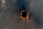
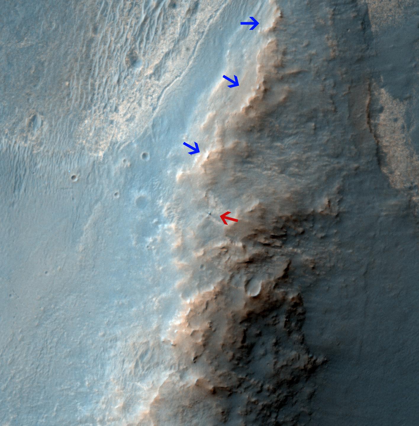
2018-04-02 |
Mars
|
Mars Reconnaissance Orbiter (MRO)
|
HiRISE
|
2880x1800x3 |
|
-
PIA22346:
-
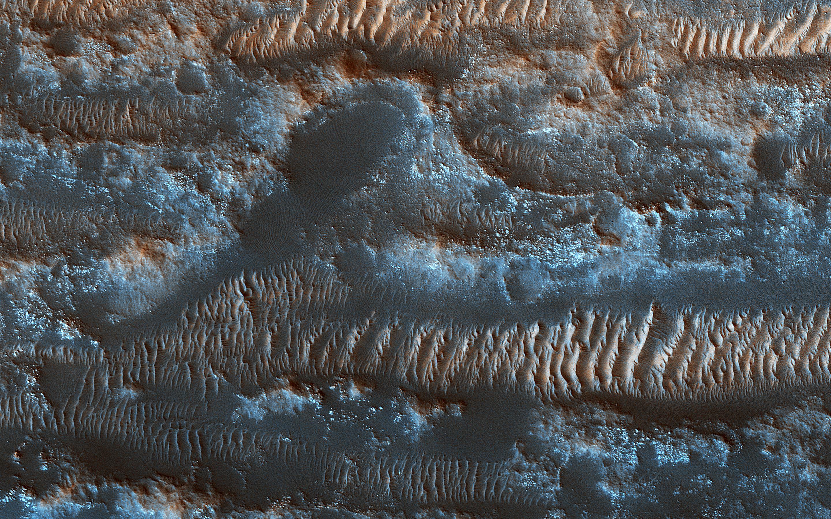
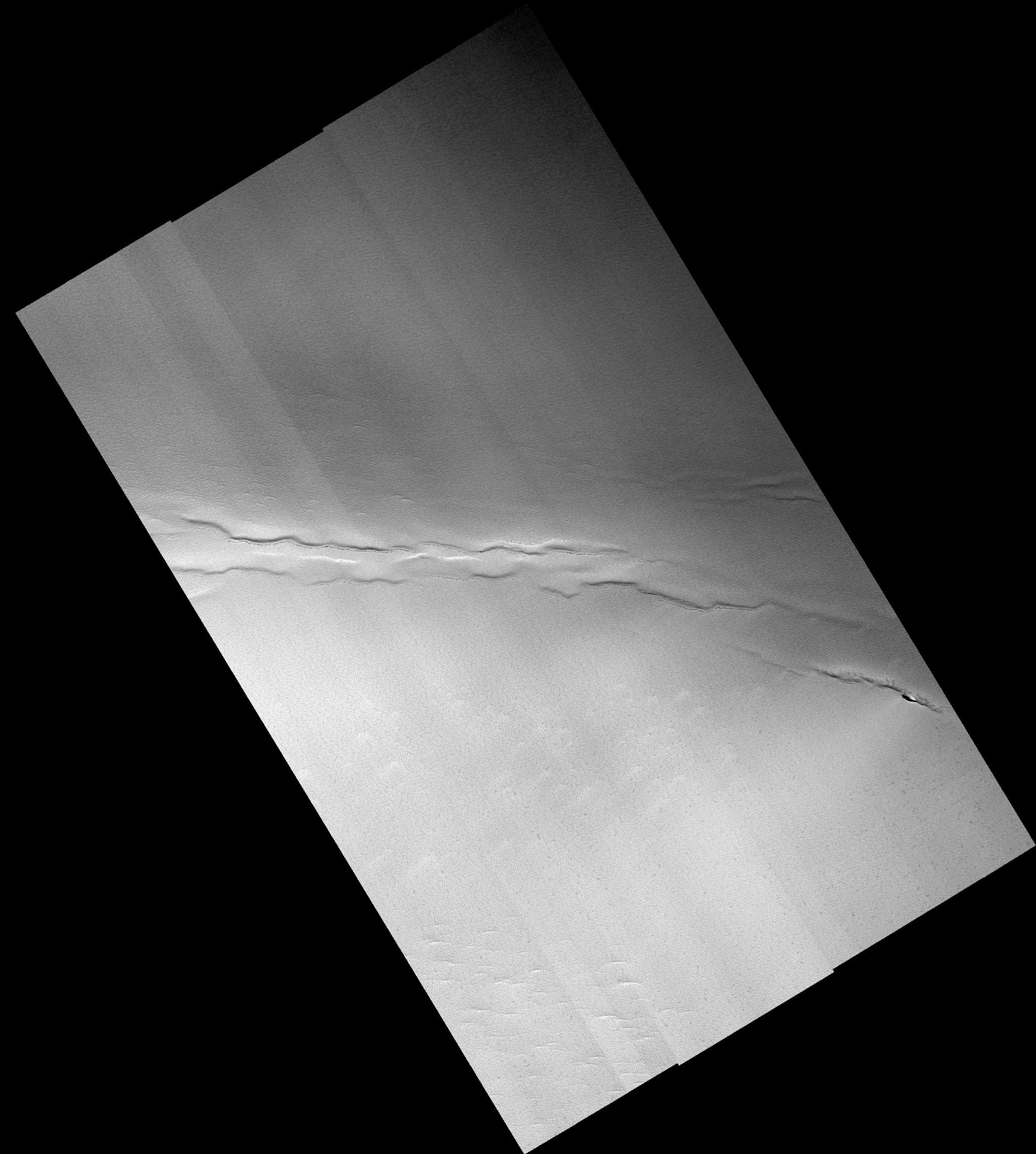
The Moving Sands of Lobo Vallis
Full Resolution:
TIFF
(15.56 MB)
JPEG
(1.261 MB)
|
|
|
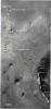
2003-09-25 |
Mars
|
Mars Reconnaissance Orbiter (MRO)
|
|
3201x2921x3 |
|
-
PIA04758:
-
Artist's Concept of Mars Reconnaissance Orbiter
Full Resolution:
TIFF
(15.99 MB)
JPEG
(856.5 kB)
|
|
|
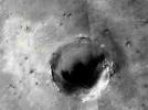
2010-02-17 |
Mars
|
Mars Reconnaissance Orbiter (MRO)
|
HiRISE
|
1676x1519x1 |
|
-
PIA12840:
-
Terrain Model of Mars' Mojave Crater
Full Resolution:
TIFF
(2.549 MB)
JPEG
(380.7 kB)
|
|
|
2006-03-10 |
Deimos
|
Mars Reconnaissance Orbiter (MRO)
|
Optical Navigation Camera
|
791x700x3 |
|
-
PIA02699:
-
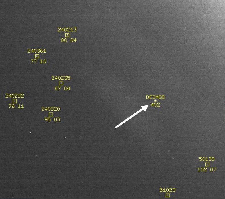
Optical Navigation Demonstration Near Mars
Full Resolution:
TIFF
(1.663 MB)
JPEG
(71.03 kB)
|
|
|
2006-03-24 |
Mars
|
Mars Reconnaissance Orbiter (MRO)
|
HiRISE
|
1092x851x1 |

|
-
PIA08013:
-
First Mars Image from Newly Arrived Camera
Full Resolution:
TIFF
(930.5 kB)
JPEG
(146.1 kB)
|
|
|
2006-03-24 |
Mars
|
Mars Reconnaissance Orbiter (MRO)
|
HiRISE
|
20048x9500x1 |
|
-
PIA08014:
-
Detail of First Mars Image from Newly Arrived Camera
Full Resolution:
TIFF
(190.5 MB)
JPEG
(19.19 MB)
|
|
|
2006-03-31 |
Mars
|
Mars Reconnaissance Orbiter (MRO)
|
MCS
|
880x300x3 |
|
-
PIA08030:
-
First Data from Mars Climate Sounder
Full Resolution:
TIFF
(793 kB)
JPEG
(12.12 kB)
|
|
|
2006-04-07 |
Mars
|
Mars Reconnaissance Orbiter (MRO)
|
HiRISE
|
3048x9280x3 |
|
-
PIA08061:
-
First Color HiRISE Image of Mars
Full Resolution:
TIFF
(84.86 MB)
JPEG
(4.953 MB)
|
|
|
2006-04-07 |
Mars
|
Mars Reconnaissance Orbiter (MRO)
|
HiRISE
|
3000x2299x3 |
|
-
PIA08054:
-
Perspective View of HiRISE First Image
Full Resolution:
TIFF
(20.69 MB)
JPEG
(998.3 kB)
|
|
|
2006-04-07 |
Mars
|
Mars Reconnaissance Orbiter (MRO)
|
HiRISE
|
10040x26011x1 |
|
-
PIA08049:
-
Sample of the Argyre Impact Basin Rim
Full Resolution:
TIFF
(261.2 MB)
JPEG
(39.48 MB)
|
|
|
2006-04-07 |
Mars
|
Mars Reconnaissance Orbiter (MRO)
|
HiRISE
|
20081x5523x1 |
|
-
PIA08047:
Landscape West of Bosporos Rupes
Full Resolution:
TIFF
(110.9 MB)
JPEG
(17.23 MB)
|
|
|
2006-04-07 |
Mars
|
Mars Reconnaissance Orbiter (MRO)
|
HiRISE
|
20081x5164x1 |
|
-
PIA08048:
Landscape Northeast of Halley Crater
Full Resolution:
TIFF
(103.7 MB)
JPEG
(21.2 MB)
|
|
|
2006-04-07 |
Mars
|
Mars Reconnaissance Orbiter (MRO)
|
HiRISE
|
6045x23024x1 |
|
-
PIA08050:
-
Sample of Mid-latitude Southern Highlands
Full Resolution:
TIFF
(139.4 MB)
JPEG
(18.22 MB)
|
|
|
2006-04-07 |
Mars
|
Mars Reconnaissance Orbiter (MRO)
|
HiRISE
|
6045x17003x1 |
|
-
PIA08051:
-
A Myriad of Geologic Processes in Terra Cimmeria
Full Resolution:
TIFF
(102.9 MB)
JPEG
(16.25 MB)
|
|
|
2006-04-07 |
Mars
|
Mars Reconnaissance Orbiter (MRO)
|
HiRISE
|
5017x5634x1 |
|
-
PIA08052:
-
Twilight Imaging of Kepler Crater Floor
Full Resolution:
TIFF
(28.31 MB)
JPEG
(6.127 MB)
|
|
|
2006-04-07 |
Mars
|
Mars Reconnaissance Orbiter (MRO)
|
HiRISE
|
3212x1600x3 |

|
-
PIA08053:
-
First HiRISE Image of Mars: Topographic Model from Photoclinometry
Full Resolution:
TIFF
(15.42 MB)
JPEG
(1.482 MB)
|
|
|
2006-04-07 |
Mars
|
Mars Reconnaissance Orbiter (MRO)
|
HiRISE
|
20081x9523x1 |
|
-
PIA08060:
-
First HiRISE Image of Mars
Full Resolution:
TIFF
(191.2 MB)
JPEG
(16.72 MB)
|
|
|
2006-09-29 |
Mars
|
Mars Reconnaissance Orbiter (MRO)
|
CRISM
|
192x2700x3 |

|
-
PIA08788:
-
New Spectrometer Begins its Global Map of Mars
Full Resolution:
TIFF
(946.5 kB)
JPEG
(84.73 kB)
|
|
|
2006-09-29 |
Mars
|
Mars Reconnaissance Orbiter (MRO)
|
HiRISE
|
2001x1485x1 |

|
-
PIA08789:
-
New Mars Camera's First Image of Mars from Mapping Orbit
Full Resolution:
TIFF
(2.975 MB)
JPEG
(512.6 kB)
|
|
|
2006-09-30 |
Mars
|
Mars Reconnaissance Orbiter (MRO)
|
HiRISE
|
13469x13491x1 |
|
-
PIA08791:
-
North Polar Layered Deposits in Summer
Full Resolution:
TIFF
(181.7 MB)
JPEG
(8.903 MB)
|
|
|
2006-10-01 |
Mars
|
Mars Reconnaissance Orbiter (MRO)
|
HiRISE
|
23444x23377x1 |
|
-
PIA08792:
-
New Mars Camera's First Image of Mars from Mapping Orbit (Full Frame)
Full Resolution:
TIFF
(548.1 MB)
JPEG
(47.26 MB)
|
|
|
2006-10-16 |
Mars
|
Mars Reconnaissance Orbiter (MRO)
|
HiRISE
|
4613x4320x3 |
|
-
PIA01920:
-
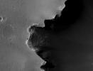
Crater Edge in Terra Sirenum
Full Resolution:
TIFF
(59.78 MB)
JPEG
(2.617 MB)
|
|
|
2006-10-16 |
Mars
|
Mars Reconnaissance Orbiter (MRO)
|
HiRISE
|
7365x4320x3 |

|
-
PIA01921:
-
Part of Mawrth Vallis
Full Resolution:
TIFF
(95.45 MB)
JPEG
(3.572 MB)
|
|
|
2006-10-16 |
Mars
|
Mars Reconnaissance Orbiter (MRO)
|
HiRISE
|
1016x996x3 |
|
-
PIA01923:
-
Gullies in Sirenum Terra, Mars
Full Resolution:
TIFF
(3.04 MB)
JPEG
(144.3 kB)
|
|
|
2006-10-16 |
Mars
|
Mars Reconnaissance Orbiter (MRO)
|
HiRISE
|
1408x1107x3 |
|
-
PIA01924:
-
Diversity in Mawrth Region, Mars
Full Resolution:
TIFF
(4.685 MB)
JPEG
(256.7 kB)
|
|
|
2006-10-16 |
Mars
|
Mars Reconnaissance Orbiter (MRO)
|
HiRISE
|
888x1309x1 |
|
-
PIA01925:
-
North Polar Layers, Mars
Full Resolution:
TIFF
(1.164 MB)
JPEG
(203.1 kB)
|
|
|
2006-10-16 |
Mars
|
Mars Reconnaissance Orbiter (MRO)
|
HiRISE
|
9687x4320x1 |

|
-
PIA01926:
-
Head of Chasma Boreale Near Mars' North Pole
Full Resolution:
TIFF
(41.85 MB)
JPEG
(3.691 MB)
|
|
|
2006-10-16 |
Mars
|
Mars Reconnaissance Orbiter (MRO)
|
CRISM
|
1044x1340x3 |
|
-
PIA01922:
-
Chasma Boreale in the North Polar Region
Full Resolution:
TIFF
(4.202 MB)
JPEG
(79.27 kB)
|
|
|
2006-10-16 |
Mars
|
Mars Reconnaissance Orbiter (MRO)
|
CTX
|
1264x12544x1 |

|
-
PIA01930:
-
Context Camera Image of North Polar Chasma Boreale
Full Resolution:
TIFF
(15.87 MB)
JPEG
(611.2 kB)
|
|
|
2006-10-16 |
Mars
|
Mars Reconnaissance Orbiter (MRO)
|
CTX
|
5056x7168x1 |
|
-
PIA01931:
-
Crater in Terra Sirenum with Gullied Walls
Full Resolution:
TIFF
(36.3 MB)
JPEG
(5.535 MB)
|
|
|
2006-10-16 |
Mars
|
Mars Reconnaissance Orbiter (MRO)
|
CTX
|
5056x12288x1 |
|
-
PIA01932:
-
Layered Rocks Near Mawrth Vallis
Full Resolution:
TIFF
(62.23 MB)
JPEG
(6.478 MB)
|
|
|
2006-10-16 |
Mars
|
Mars Reconnaissance Orbiter (MRO)
|
CRISM
|
1550x2131x3 |
|
-
PIA01927:
-
Spectrometer Observations Near Mawrth Vallis
Full Resolution:
TIFF
(9.926 MB)
JPEG
(364.1 kB)
|
|
|
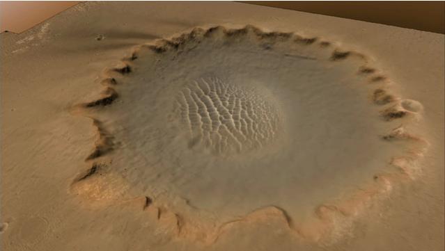
2006-12-05 |
Mars
|
Mars Reconnaissance Orbiter (MRO)
|
HiRISE
|
4088x4103x3 |
|
-
PIA01883:
-
Stereo View of Victoria Crater
Full Resolution:
TIFF
(50.32 MB)
JPEG
(978.9 kB)
|
|
|
2006-12-13 |
Mars
|
Mars Reconnaissance Orbiter (MRO)
|
Shallow Subsurface Radar (SHARAD)
|
3194x591x3 |
|
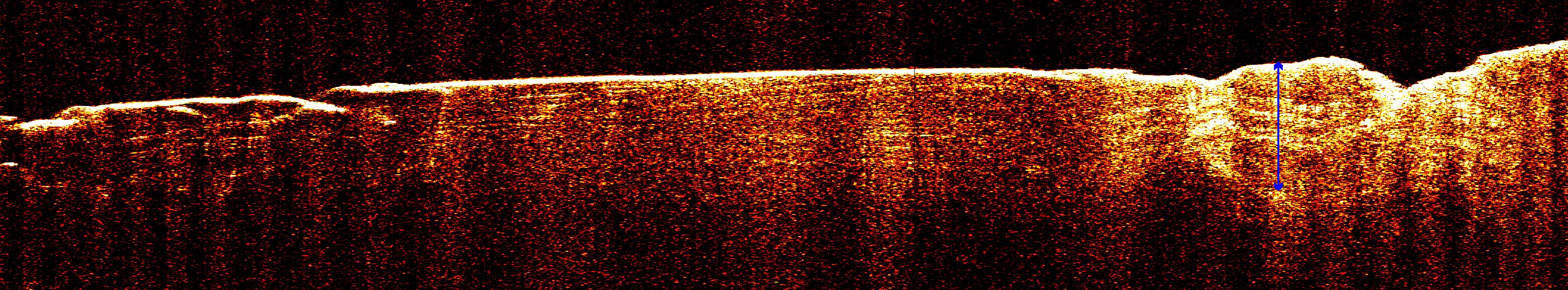
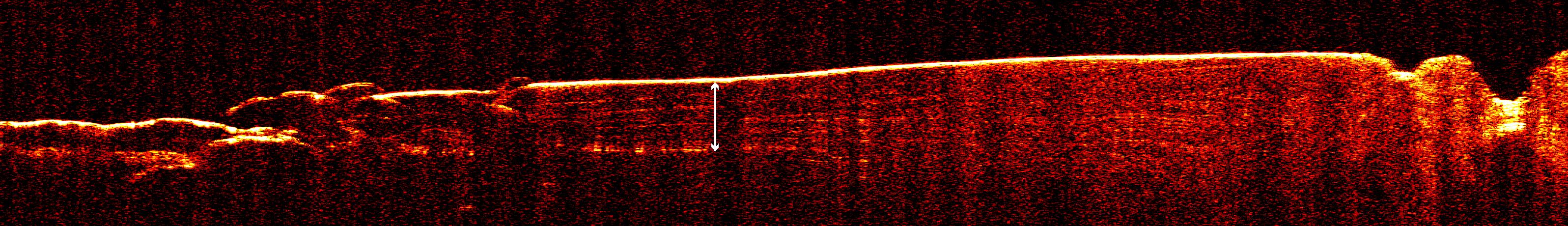
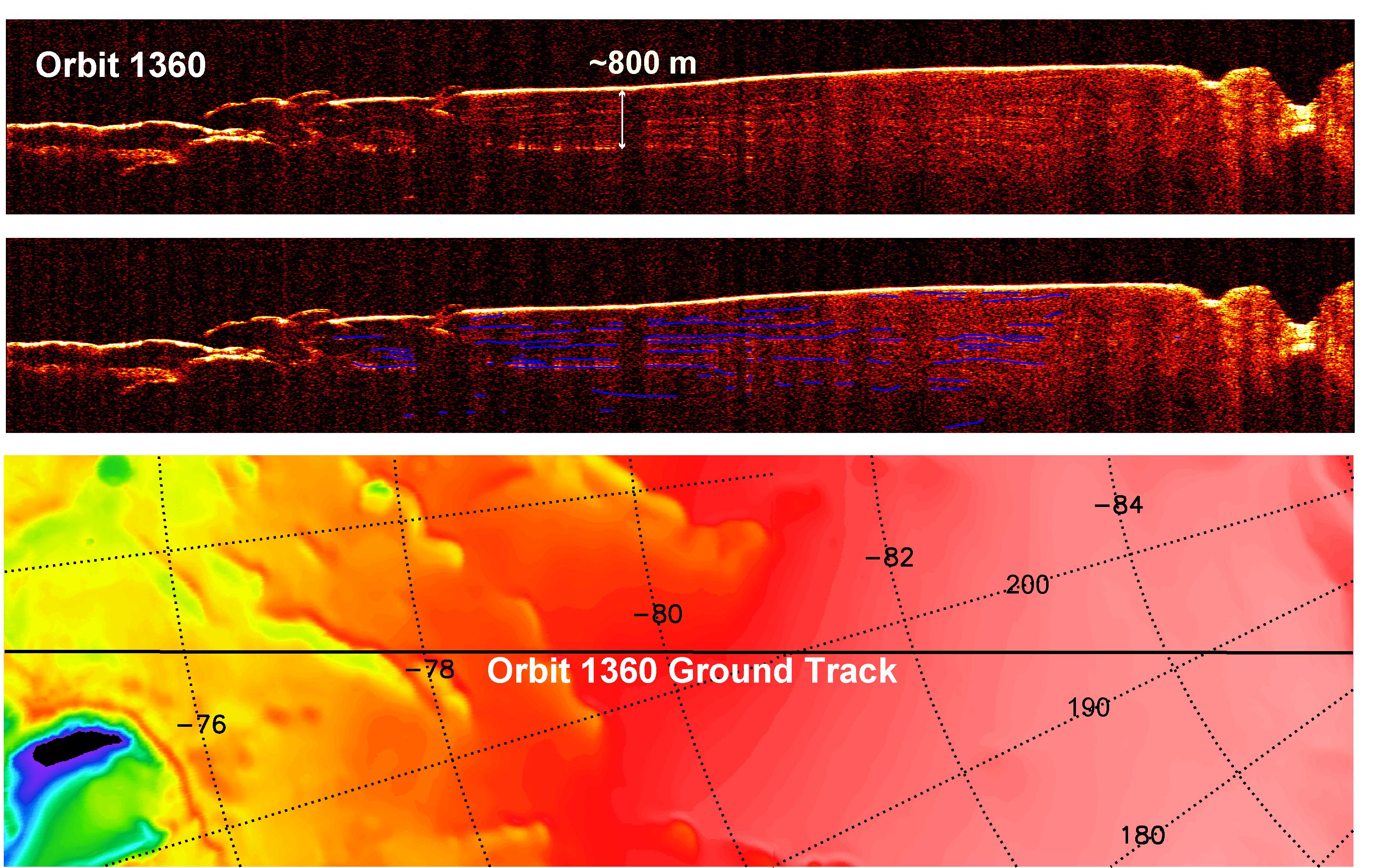
-
PIA09095:
Radar View of Layering near Mars' South Pole, Orbit 1360
Full Resolution:
TIFF
(5.663 MB)
JPEG
(722.7 kB)
|
|
|
2006-12-13 |
Mars
|
Mars Reconnaissance Orbiter (MRO)
|
Shallow Subsurface Radar (SHARAD)
|
3253x2415x3 |
|
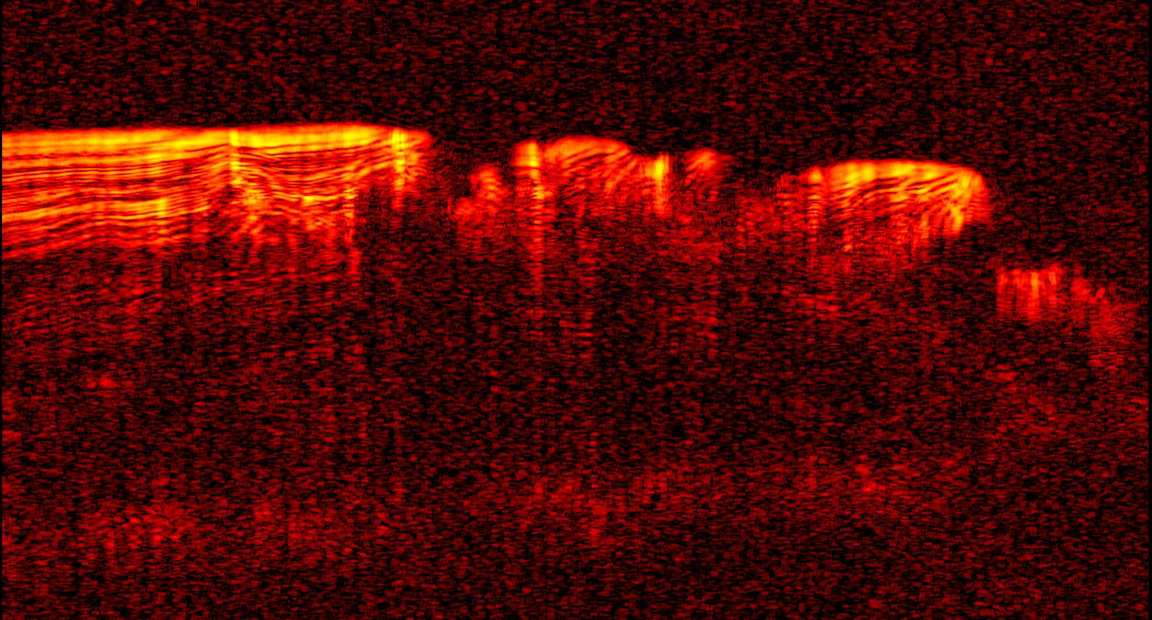
-
PIA09076:
-
Interpreting Radar View near Mars' South Pole, Orbit 1334
Full Resolution:
TIFF
(23.57 MB)
JPEG
(1.764 MB)
|
|
|
2006-12-13 |
Mars
|
Mars Reconnaissance Orbiter (MRO)
|
Shallow Subsurface Radar (SHARAD)
|
3192x460x3 |
|
-
PIA09073:
Radar View of Layering near Mars' South Pole, Orbit 1360
Full Resolution:
TIFF
(4.405 MB)
JPEG
(446.8 kB)
|
|
|
2006-12-13 |
Mars
|
Mars Reconnaissance Orbiter (MRO)
|
Shallow Subsurface Radar (SHARAD)
|
3275x2065x3 |

|
-
PIA09075:
-
Interpreting Radar View near Mars' South Pole, Orbit 1360
Full Resolution:
TIFF
(20.29 MB)
JPEG
(1.198 MB)
|
|
|
2006-12-13 |
Mars
|
Mars Reconnaissance Orbiter (MRO)
|
Shallow Subsurface Radar (SHARAD)
|
1617x870x3 |

|
-
PIA09096:
-
Interpreting Radar View near Mars' South Pole, Orbit 1334
Full Resolution:
TIFF
(1.41 MB)
JPEG
(299.9 kB)
|
|
|
2006-12-13 |
Mars
|
Mars Reconnaissance Orbiter (MRO)
|
Shallow Subsurface Radar (SHARAD)
|
2634x1934x3 |
|
-
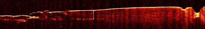
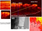
PIA09074:
-
Interpreting Radar View near Mars' North Pole, Orbit 1512
Full Resolution:
TIFF
(15.3 MB)
JPEG
(808.7 kB)
|
|
|
2006-12-13 |
Mars
|
Mars Reconnaissance Orbiter (MRO)
|
CRISM
High Resolution Imaging Science Experiment (HiRISE)
|
2614x2383x3 |
|
-
PIA09093:
-
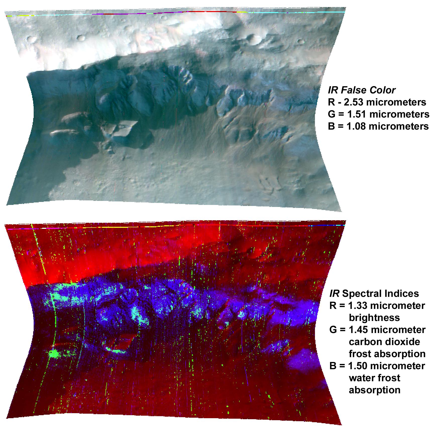
Clay at Nili Fossae
Full Resolution:
TIFF
(18.71 MB)
JPEG
(1.42 MB)
|
|
|
2006-12-13 |
Mars
|
Mars Reconnaissance Orbiter (MRO)
|
CRISM
|
1110x996x3 |
|
-
PIA09094:
-
Gypsum at Olympia Undae
Full Resolution:
TIFF
(3.321 MB)
JPEG
(163.7 kB)
|
|
|
2006-12-13 |
Mars
|
Mars Reconnaissance Orbiter (MRO)
|
HiRISE
|
4000x10119x3 |
|
-
PIA09097:
-
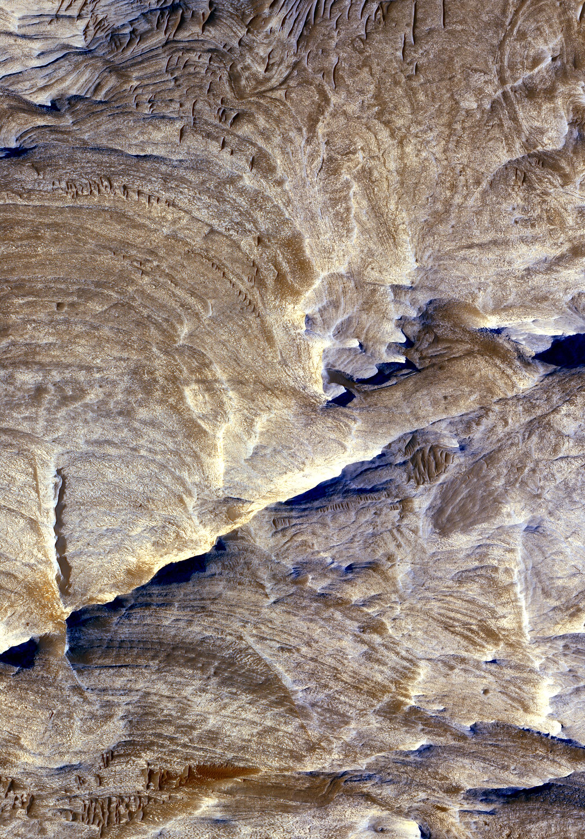
Layers Exposed at Polar Canyon
Full Resolution:
TIFF
(121.4 MB)
JPEG
(5.384 MB)
|
|
|
2006-12-13 |
Mars
|
Mars Reconnaissance Orbiter (MRO)
|
HiRISE
|
2048x2283x1 |
|
-
PIA09098:
-
Pits in Polar Cap
Full Resolution:
TIFF
(4.68 MB)
JPEG
(406.9 kB)
|
|
|
2006-12-22 |
Mars
|
Mars Reconnaissance Orbiter (MRO)
|
CRISM
|
1728x1728x3 |
|
-
PIA09101:
-
Seasonal Frost in Terra Sirenum
Full Resolution:
TIFF
(8.972 MB)
JPEG
(367.2 kB)
|
|
|
2007-01-11 |
Mars
|
Mars Reconnaissance Orbiter (MRO)
|
HiRISE
|
4000x4000x1 |
|
-
PIA09105:
-
Mars Pathfinder Landing Site and Surroundings
Full Resolution:
TIFF
(16.02 MB)
JPEG
(2.384 MB)
|
|
|
2007-02-13 |
Mars
|
Mars Reconnaissance Orbiter (MRO)
|
CRISM
|
758x1550x3 |
|
-
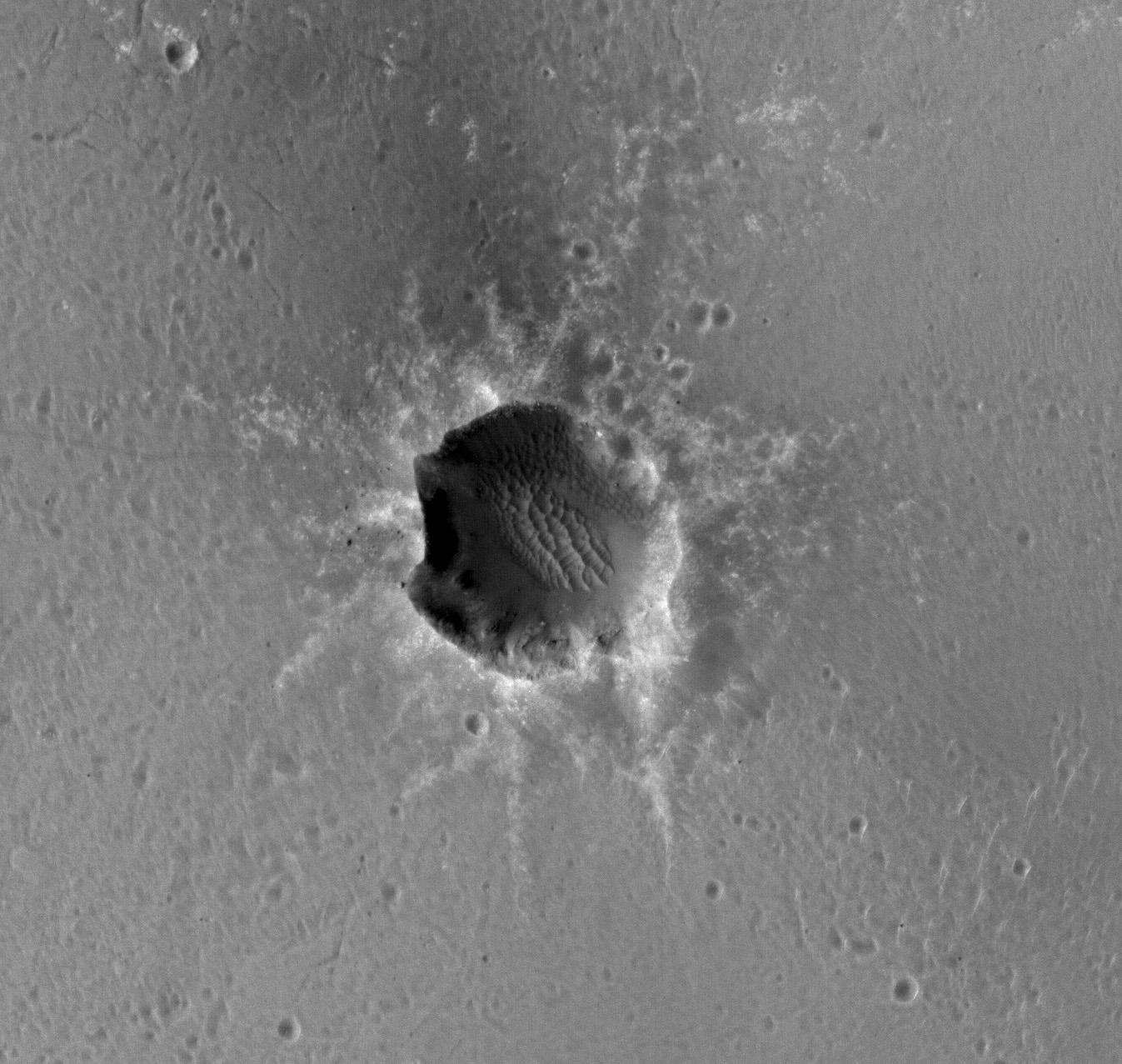
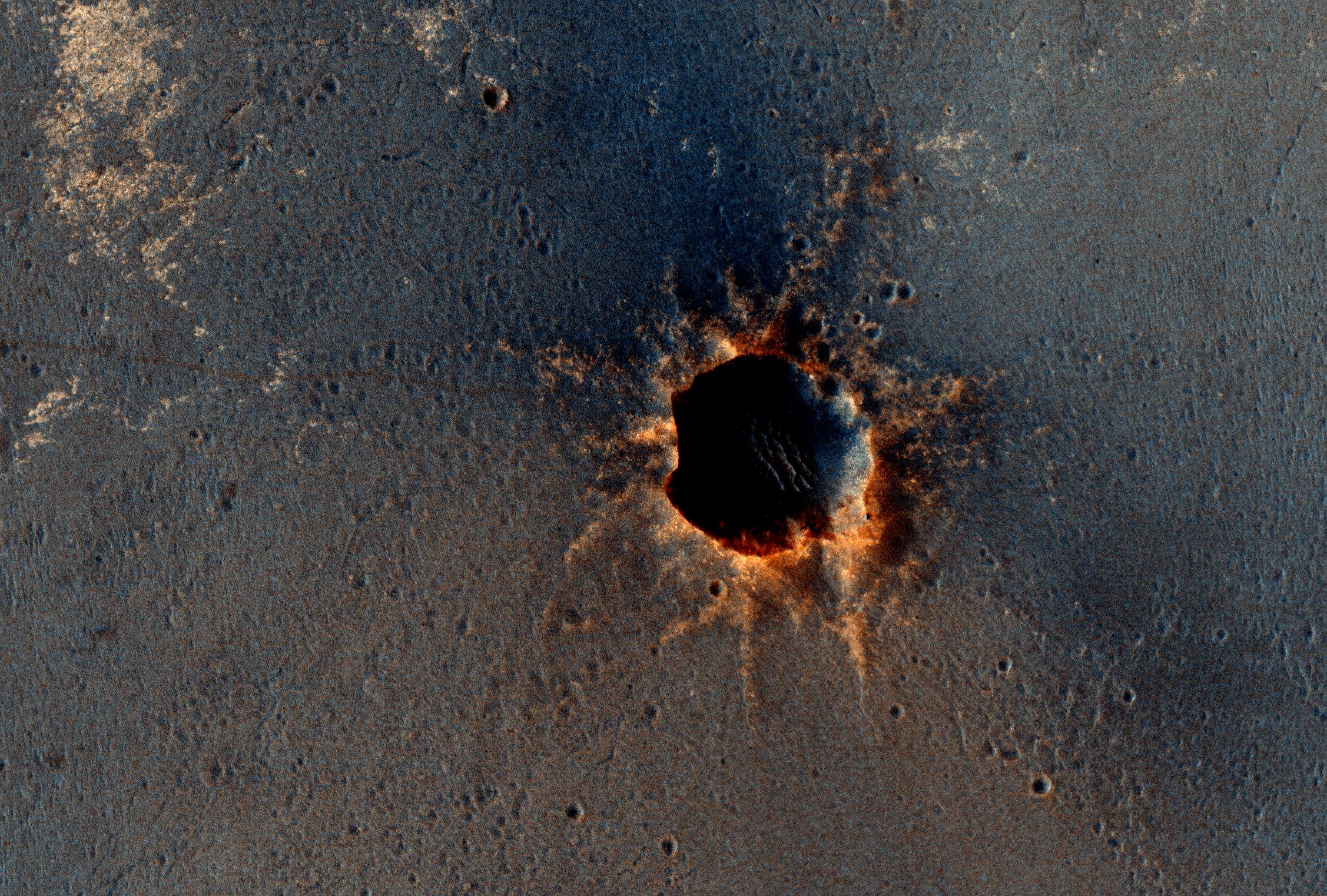
PIA09195:
-
A Fresh Crater Drills to Tharsis Bedrock
Full Resolution:
TIFF
(3.529 MB)
JPEG
(92.81 kB)
|
|
|
2007-02-15 |
Mars
|
Mars Reconnaissance Orbiter (MRO)
|
HiRISE
|
2025x2905x3 |
|
-
PIA09189:
-
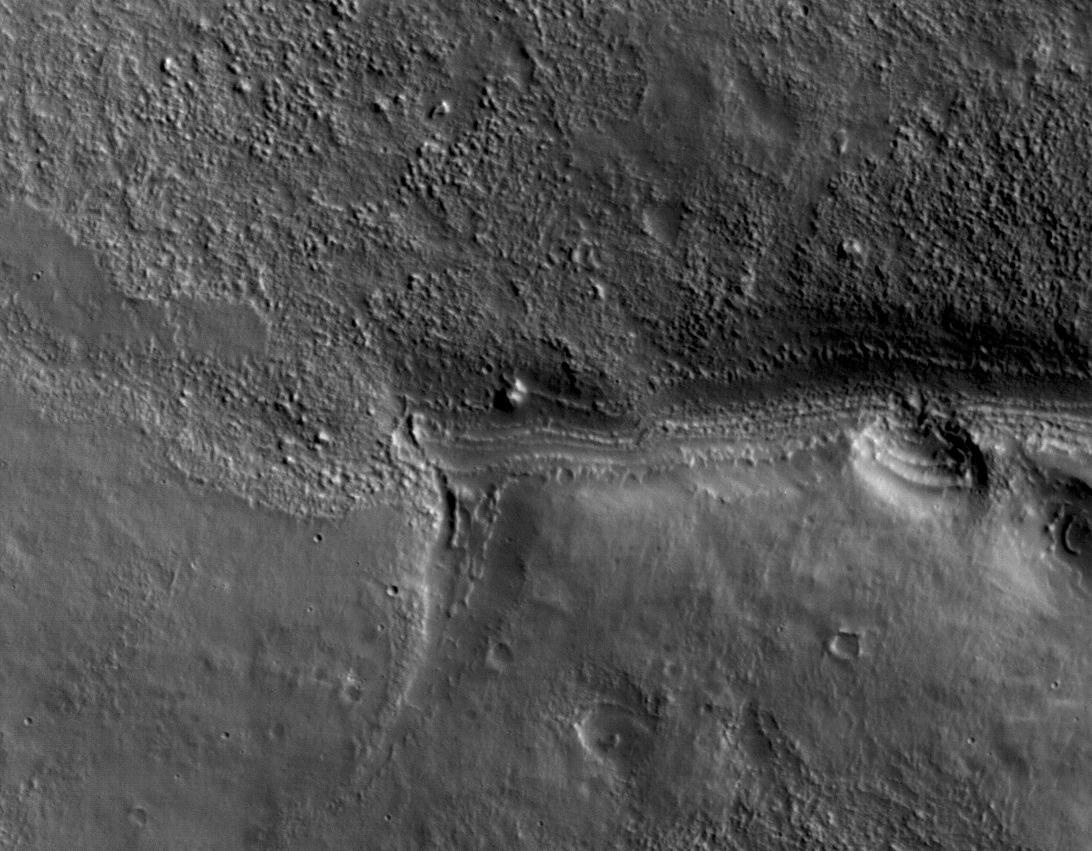
Ridges as Evidence of Fluid Alteration
Full Resolution:
TIFF
(17.67 MB)
JPEG
(1.767 MB)
|


